
Thurgau
41 known cemeteries in Thurgau, Switzerland.
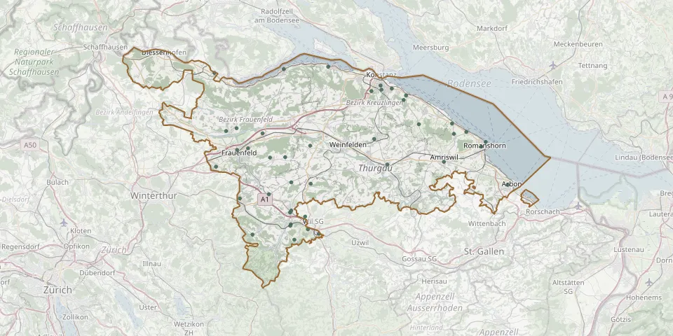 © OpenStreetMap
- Rickenbach bei WilGPS coordinates: 47.44873° N, 9.05241° E
- ScherzingenGPS coordinates: 47.63187° N, 9.22316° E
- Dozwil CemeteryGPS coordinates: 47.58126° N, 9.31697° E
- Kesswil CemeteryGPS coordinates: 47.59484° N, 9.31314° E
- Aadorf Reformed CemeteryGPS coordinates: 47.49550° N, 8.89746° E
- Amriswil CemeteryGPS coordinates: 47.54415° N, 9.29726° E
- Arbon CemeteryGPS coordinates: 47.51357° N, 9.42233° E
- Bichelsee CemeteryGPS coordinates: 47.44765° N, 8.92239° E
- Bottighofen Woodland CemeteryGPS coordinates: 47.62577° N, 9.21851° E
- Dreibrunnen Cemetery, BronschhofenGPS coordinates: 47.47144° N, 9.02523° E
- Egelshofen Central Cemetery Funeral HallGPS coordinates: 47.63935° N, 9.17506° E
- Egelshofen Evangelical CemeteryGPS coordinates: 47.64505° N, 9.17299° E
- Ermatingen CemeteryGPS coordinates: 47.66958° N, 9.07036° E
- Gachnang CemeteryGPS coordinates: 47.53761° N, 8.85089° E
- Kehlhof CemeteryGPS coordinates: 47.57447° N, 9.16067° E
- Kirchberg CemeteryGPS coordinates: 47.54951° N, 8.95679° E
- KirchhaldenGPS coordinates: 47.44068° N, 9.00424° E
- Kreuzlingen CemeteryGPS coordinates: 47.64095° N, 9.19525° E
- Kreuzlingen Jewish CemeteryGPS coordinates: 47.63778° N, 9.15511° E
- Kurzdorf CemeteryGPS coordinates: 47.55970° N, 8.89202° E
- Langrickenbach CemeteryGPS coordinates: 47.59370° N, 9.24804° E
- Laubenacker CemeteryGPS coordinates: 47.58167° N, 8.94196° E
- Leutmerken CemeteryGPS coordinates: 47.56533° N, 9.03538° E
- Lommis CemeteryGPS coordinates: 47.51685° N, 8.99840° E
- Lustdorf CemeteryGPS coordinates: 47.55031° N, 8.98648° E
- Münchwilen Reformed CemeteryGPS coordinates: 47.47703° N, 8.99614° E
- Münchwilen TG Catholic CemeteryGPS coordinates: 47.47956° N, 8.99825° E
- Oberkirch CemeteryGPS coordinates: 47.56206° N, 8.91377° E
- Propstei Cemetery, WagenhausenGPS coordinates: 47.66182° N, 8.84761° E
- Reformed Church Churchyard, SteckbornGPS coordinates: 47.66675° N, 8.98353° E