
Zürich
165 known cemeteries in Zürich, Switzerland.
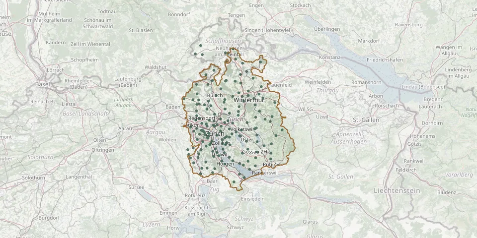 © OpenStreetMap
- Dietikon CemeteryGPS coordinates: 47.39792° N, 8.40676° E
- Niederhasli CemeteryGPS coordinates: 47.48220° N, 8.48232° E
- Rosenberg CemeteryGPS coordinates: 47.51612° N, 8.72431° E
- Eichbühl CemeteryGPS coordinates: 47.38520° N, 8.47240° E
- Fluntern CemeteryGPS coordinates: 47.38319° N, 8.57121° E
- Meilen CemeteryGPS coordinates: 47.27157° N, 8.63911° E
- Winterthur SeenGPS coordinates: 47.48122° N, 8.76142° E
- FeuerthalenGPS coordinates: 47.69054° N, 8.64046° E
- Strässler 10GPS coordinates: 47.61070° N, 8.53450° E
- Reformierte Kirche FlaachGPS coordinates: 47.57302° N, 8.60247° E
- Kirche HenggartGPS coordinates: 47.56264° N, 8.68321° E
- Schwamendingen CemeteryGPS coordinates: 47.40170° N, 8.57450° E
- Agudas Achim Jewish Cemetery, ZurichGPS coordinates: 47.37038° N, 8.48582° E
- Halden CemeteryGPS coordinates: 47.42875° N, 8.57082° E
- Reformierte Kirche Berg am IrchelGPS coordinates: 47.57045° N, 8.59826° E
- Üetliberg CemeteryGPS coordinates: 47.35700° N, 8.50060° E
- Betten CemeteryGPS coordinates: 47.49986° N, 8.45037° E
- Weid CemeteryGPS coordinates: 47.24191° N, 8.53923° E
- Dorf CemeteryGPS coordinates: 47.56962° N, 8.65150° E
- Elgg CemeteryGPS coordinates: 47.48990° N, 8.87160° E
- Adliswil CemeteryGPS coordinates: 47.30688° N, 8.52839° E
- Affoltern am Albis CemeteryGPS coordinates: 47.28391° N, 8.44656° E
- Albisrieden CemeteryGPS coordinates: 47.37939° N, 8.48101° E
- Altstetten CemeteryGPS coordinates: 47.38280° N, 8.47607° E
- Andelfingen CemeteryGPS coordinates: 47.59502° N, 8.68183° E
- Arni AG CemeteryGPS coordinates: 47.31970° N, 8.42012° E
- Auegst am Albis CemeteryGPS coordinates: 47.26697° N, 8.48923° E
- Awandel CemeteryGPS coordinates: 47.36334° N, 8.68171° E
- Bachs CemeteryGPS coordinates: 47.52272° N, 8.44252° E
- Bachtobel Cemetery, BassersdorfGPS coordinates: 47.44961° N, 8.62096° E