
Adıyaman
22 known cemeteries in Adıyaman, Türkiye.
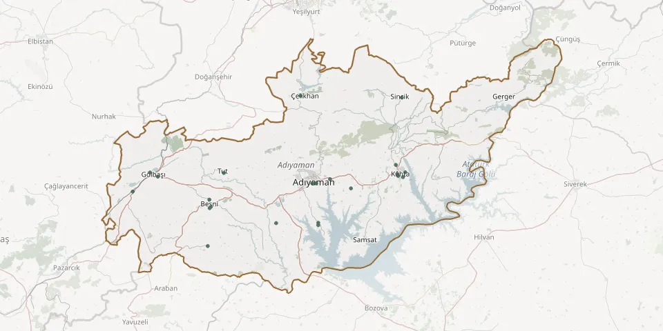 © OpenStreetMap
- Adıyaman CemeteryGPS coordinates: 37.63158° N, 38.29505° E
- Adıyaman Old CemeteryGPS coordinates: 37.75607° N, 38.28684° E
- Adıyaman Syriac Orthodox CemeteryGPS coordinates: 37.75650° N, 38.27088° E
- Balkar CemeteryGPS coordinates: 37.73037° N, 37.55648° E
- Besni CemeteryGPS coordinates: 37.68193° N, 37.86717° E
- Bozhüyük CemeteryGPS coordinates: 37.62419° N, 38.29493° E
- Çakırhüyük Municipal CemeteryGPS coordinates: 37.55858° N, 37.85556° E
- Hacıköy CemeteryGPS coordinates: 38.03119° N, 38.22420° E
- Hıra Municipal Cemetery, BesniGPS coordinates: 37.70490° N, 37.86152° E
- Kâhta CemeteryGPS coordinates: 37.78501° N, 38.60856° E
- Kâhta CemeteryGPS coordinates: 37.77949° N, 38.61219° E
- Kahta Municipal CemeteryGPS coordinates: 37.81384° N, 38.60350° E
- Kâhta New Neighbourhood CemeteryGPS coordinates: 37.77544° N, 38.63172° E
- Külafhüyük Village CemeteryGPS coordinates: 37.63117° N, 38.12755° E
- Kuru Geçit Cemetery, GölbaşıGPS coordinates: 37.79021° N, 37.62588° E
- Kuştepe Village CemeteryGPS coordinates: 37.74006° N, 38.42505° E
- Menderes CemeteryGPS coordinates: 37.79076° N, 38.64063° E
- Pınarbaşı CemeteryGPS coordinates: 37.67817° N, 37.86236° E
- Sincik CemeteryGPS coordinates: 38.02594° N, 38.62744° E
- Tut CemeteryGPS coordinates: 37.78846° N, 37.91969° E
- Yarbaşı Municipal CemeteryGPS coordinates: 37.77691° N, 37.65652° E
- Ziyaretpayamlı CemeteryGPS coordinates: 37.76930° N, 38.34127° E