
Tekirdağ
210 known cemeteries in Tekirdağ, Türkiye.
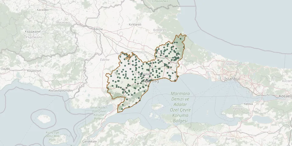 © OpenStreetMap
- Emiryakup CemeteryGPS coordinates: 41.06036° N, 27.18942° E
- Esendik CemeteryGPS coordinates: 40.78165° N, 27.16567° E
- Esenler CemeteryGPS coordinates: 41.21598° N, 27.64931° E
- Fatih Neighbourhood CemeteryGPS coordinates: 41.29651° N, 27.94201° E
- Gazioğlu Neighbourhood CemeteryGPS coordinates: 41.02287° N, 27.63361° E
- Göçerler CemeteryGPS coordinates: 41.34001° N, 27.74133° E
- Gündüzlü CemeteryGPS coordinates: 41.07933° N, 27.51182° E
- Güneşli CemeteryGPS coordinates: 41.02074° N, 26.91081° E
- Güngörmez CemeteryGPS coordinates: 41.49292° N, 27.97873° E
- Güveçli Neighbourhood CemeteryGPS coordinates: 40.96606° N, 27.34633° E
- Güzelköy CemeteryGPS coordinates: 40.73786° N, 27.29461° E
- Hacıköy Neighbourhood CemeteryGPS coordinates: 41.00634° N, 27.34587° E
- Hacısungur CemeteryGPS coordinates: 41.01447° N, 27.03553° E
- Hanoğlu CemeteryGPS coordinates: 41.20187° N, 27.36990° E
- Hayrabolu CemeteryGPS coordinates: 41.20484° N, 27.10865° E
- Hayrabolu District CemeteryGPS coordinates: 41.20619° N, 27.10855° E
- Hedeyli Neighbourhood CemeteryGPS coordinates: 41.33119° N, 27.03136° E
- Hereke CemeteryGPS coordinates: 40.90433° N, 27.09279° E
- Hoşköy CemeteryGPS coordinates: 40.70609° N, 27.30797° E
- Husunlu Neighbourhood CemeteryGPS coordinates: 41.04707° N, 27.62834° E
- İbrice CemeteryGPS coordinates: 40.95925° N, 26.87309° E
- İğneler Neighbourhood CemeteryGPS coordinates: 41.35212° N, 27.60895° E
- İnanlı CemeteryGPS coordinates: 41.19909° N, 27.46875° E
- İnecik Neighbourhood CemeteryGPS coordinates: 40.93416° N, 27.27483° E
- İstasyon CemeteryGPS coordinates: 41.27735° N, 28.00013° E
- Kabahöyük CemeteryGPS coordinates: 41.21895° N, 26.97706° E
- Kadriye Neighbourhood CemeteryGPS coordinates: 41.34625° N, 27.00259° E
- Kandamış CemeteryGPS coordinates: 41.14049° N, 27.24597° E
- Kandamış CemeteryGPS coordinates: 41.15042° N, 27.24124° E
- Kapaklı CemeteryGPS coordinates: 41.32523° N, 27.97612° E