
Chernihiv Oblast
216 known cemeteries in Chernihiv Oblast, Ukraine.
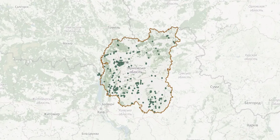 © OpenStreetMap
- Homonyvske CemeteryGPS coordinates: 50.84588° N, 31.90522° E
- Horbove CemeteryGPS coordinates: 51.44906° N, 31.56958° E
- Irzhavets CemeteryGPS coordinates: 50.86331° N, 32.55502° E
- Irzhavets CemeteryGPS coordinates: 50.97622° N, 31.44054° E
- Irzhavetske CemeteryGPS coordinates: 50.86958° N, 32.41034° E
- Kaliuzhyntsi CemeteryGPS coordinates: 50.69686° N, 32.73992° E
- Karpylivka South CemeteryGPS coordinates: 50.98135° N, 30.82318° E
- Karpylivka South-West CemeteryGPS coordinates: 50.97621° N, 30.81045° E
- Khaliavyn CemeteryGPS coordinates: 51.59479° N, 31.30558° E
- Khlopianyky CemeteryGPS coordinates: 51.74310° N, 32.70434° E
- Komunariv Street Cemetery, NizhynGPS coordinates: 51.06406° N, 31.92083° E
- Korniiv Village CemeteryGPS coordinates: 50.82818° N, 31.11607° E
- Koropje Village CemeteryGPS coordinates: 51.02240° N, 30.83994° E
- Kosachivka CemeteryGPS coordinates: 51.09599° N, 30.64834° E
- Koshivka CemeteryGPS coordinates: 51.55394° N, 31.17705° E
- Koty Cemetery, ChernihivGPS coordinates: 51.53715° N, 31.25650° E
- Kozelets Central CemeteryGPS coordinates: 50.90730° N, 31.12974° E
- Kozelets Jewish CemeteryGPS coordinates: 50.91256° N, 31.08803° E
- Kozerihske CemeteryGPS coordinates: 51.30656° N, 31.03421° E
- Krasylivka CemeteryGPS coordinates: 51.20038° N, 31.19724° E
- Krekhaiv CemeteryGPS coordinates: 50.80290° N, 30.78645° E
- Kruchevske CemeteryGPS coordinates: 51.05983° N, 31.83697° E
- Kryvytske CemeteryGPS coordinates: 50.92011° N, 31.07897° E
- Kuchanovske CemeteryGPS coordinates: 50.83612° N, 31.93657° E
- Kukshyn CemeteryGPS coordinates: 51.16505° N, 31.64579° E
- Kunashivske CemeteryGPS coordinates: 51.04751° N, 32.01260° E
- Ladan CemeteryGPS coordinates: 50.51130° N, 32.57662° E
- Ladyzhytske East CemeteryGPS coordinates: 51.25504° N, 30.42317° E
- Ladyzhytske West CemeteryGPS coordinates: 51.25471° N, 30.40249° E
- Lebedivka CemeteryGPS coordinates: 51.24263° N, 30.97551° E