
Khmelnytskyi Oblast
596 known cemeteries in Khmelnytskyi Oblast, Ukraine.
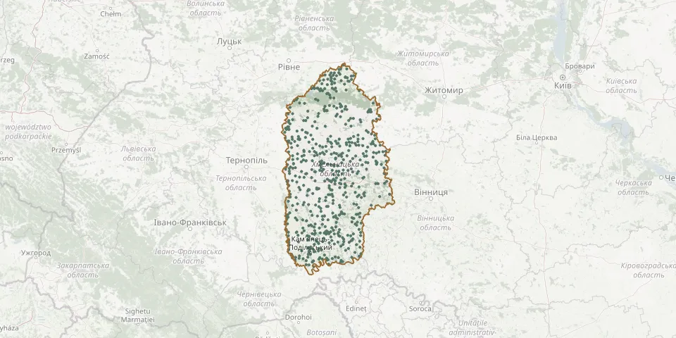 © OpenStreetMap
- Krasnosilka CemeteryGPS coordinates: 50.47023° N, 26.98873° E
- Krasnosilka CemeteryGPS coordinates: 49.77335° N, 27.29741° E
- Krasnostav Jewish CemeteryGPS coordinates: 50.41242° N, 27.18778° E
- Krasnostavtsi CemeteryGPS coordinates: 48.79061° N, 26.39784° E
- Krasyliv Catholic CemeteryGPS coordinates: 49.64476° N, 26.97361° E
- Krasyliv CemeteryGPS coordinates: 49.66982° N, 27.02813° E
- Krasyliv Municipal CemeteryGPS coordinates: 49.63372° N, 26.97445° E
- Kremenchuky CemeteryGPS coordinates: 49.81373° N, 26.97589° E
- Kreminna CemeteryGPS coordinates: 49.19368° N, 26.48391° E
- Kropyvna CemeteryGPS coordinates: 49.96509° N, 26.81326° E
- Krupets CemeteryGPS coordinates: 50.34182° N, 26.80790° E
- Krykiv CemeteryGPS coordinates: 49.02338° N, 26.21324° E
- Krynychany CemeteryGPS coordinates: 48.96255° N, 26.58958° E
- Kryvchanske CemeteryGPS coordinates: 48.60019° N, 27.06169° E
- Kryvulskyi CemeteryGPS coordinates: 49.08082° N, 27.06430° E
- Kryvyn Village CemeteryGPS coordinates: 50.34652° N, 26.68866° E
- Kudryntsi CemeteryGPS coordinates: 48.62500° N, 26.30292° E
- Kulchyny Old Jewish CemeteryGPS coordinates: 49.75689° N, 26.91563° E
- Kumaniv CemeteryGPS coordinates: 49.34589° N, 26.40370° E
- Kuniv CemeteryGPS coordinates: 50.24345° N, 26.37695° E
- Kuniv Jewish CemeteryGPS coordinates: 50.23188° N, 26.36644° E
- Kupil Catholic CemeteryGPS coordinates: 49.61578° N, 26.51345° E
- Kupil Old Jewish CemeteryGPS coordinates: 49.61749° N, 26.51873° E
- Kupyn Jewish CemeteryGPS coordinates: 49.10283° N, 26.58720° E
- Kurylivka CemeteryGPS coordinates: 49.59049° N, 26.31930° E
- Kurylivka Old CemeteryGPS coordinates: 49.58562° N, 26.31914° E
- Kushnirivka CemeteryGPS coordinates: 49.60558° N, 26.43929° E
- Kutkovetske CemeteryGPS coordinates: 49.11475° N, 26.36489° E
- Kuzmyn Jewish CemeteryGPS coordinates: 49.69286° N, 27.08492° E
- Kuzmyn Jewish CemeteryGPS coordinates: 49.26601° N, 26.53066° E