
Bristol
28 known cemeteries in Bristol, United Kingdom.
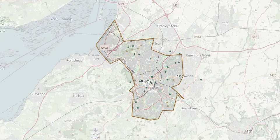 © OpenStreetMap
- Bristol Avonview CemeteryGPS coordinates: 51.45720° N, 2.54950° W
- Greenbank CemeteryGPS coordinates: 51.46836° N, 2.55403° W
- Filton CemeteryGPS coordinates: 51.49857° N, 2.54300° W
- St Michael the Archangel ChurchyardGPS coordinates: 51.46192° N, 2.52113° W
- Fishponds Baptist ChurchyardGPS coordinates: 51.48233° N, 2.52272° W
- St. John the Baptist ChurchyardGPS coordinates: 51.49477° N, 2.52058° W
- Holy Trinity ChurchyardGPS coordinates: 51.48799° N, 2.58936° W
- Canford Cemetery and CrematoriumGPS coordinates: 51.49468° N, 2.62695° W
- Holy Trinity ChurchyardGPS coordinates: 51.49398° N, 2.61601° W
- Henbury CemeteryGPS coordinates: 51.50446° N, 2.64146° W
- Brislington CemeteryGPS coordinates: 51.43555° N, 2.54380° W
- Church of St John the BaptistGPS coordinates: 51.45595° N, 2.59503° W
- Clifton Parish Lower ChurchyardGPS coordinates: 51.45471° N, 2.61091° W
- Hebron Road Burial GroundGPS coordinates: 51.44006° N, 2.60410° W
- Jewish Burial Ground, BristolGPS coordinates: 51.45316° N, 2.57798° W
- Ridgeway Jewish CemeteryGPS coordinates: 51.47500° N, 2.54887° W
- Ridgeway Park CemeteryGPS coordinates: 51.47550° N, 2.54920° W
- Saint Mary's ChurchyardGPS coordinates: 51.48150° N, 2.53000° W
- South Bristol Cemetery and CrematoriumGPS coordinates: 51.42410° N, 2.62364° W
- St. Andrew's ChurchyardGPS coordinates: 51.45438° N, 2.61475° W
- St. Barnabas Church of England ChurchyardGPS coordinates: 51.45707° N, 2.47043° W
- St Mary the Virgin Church, Leigh WoodsGPS coordinates: 51.45317° N, 2.63690° W
- St Mary the Virgin ChurchyardGPS coordinates: 51.50632° N, 2.63063° W
- St Paul's ChurchyardGPS coordinates: 51.44528° N, 2.59895° W
- St Pauls ChurchyardGPS coordinates: 51.46116° N, 2.58472° W
- St. Peter's ChurchyardGPS coordinates: 51.41543° N, 2.61917° W
- Temple ChurchyardGPS coordinates: 51.45200° N, 2.58689° W
- Unitarian Burial GroundGPS coordinates: 51.46110° N, 2.58762° W