
Cardiganshire
134 known cemeteries in Cardiganshire, United Kingdom.
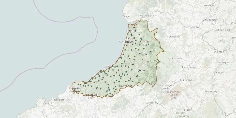 © OpenStreetMap
- Llwyndafydd CemeteryGPS coordinates: 52.17444° N, 4.38463° W
- Maen-y-groes CemeteryGPS coordinates: 52.20495° N, 4.36334° W
- Moelfryn CemeteryGPS coordinates: 52.24651° N, 4.09186° W
- Mydroilyn CemeteryGPS coordinates: 52.17396° N, 4.25585° W
- Mynwent Bwlch-llanGPS coordinates: 52.20832° N, 4.07819° W
- Mynwent LlandreGPS coordinates: 52.46320° N, 4.02731° W
- Nebo CemeteryGPS coordinates: 52.26533° N, 4.13186° W
- New Quay cemeteryGPS coordinates: 52.20781° N, 4.36958° W
- Parish cemetery, LlangynfelynGPS coordinates: 52.51103° N, 3.99311° W
- Pencader CemeteryGPS coordinates: 52.04974° N, 4.23971° W
- Pen-Cae Independent ChapelGPS coordinates: 52.18568° N, 4.29654° W
- Penmorfa GraveyardGPS coordinates: 52.14218° N, 4.47824° W
- Pennant CemeteryGPS coordinates: 52.24652° N, 4.18646° W
- Pennant CemeteryGPS coordinates: 52.24615° N, 4.18038° W
- Penrhyn-coch CemeteryGPS coordinates: 52.43854° N, 3.98691° W
- Penuwch CemeteryGPS coordinates: 52.24038° N, 4.05483° W
- Ponterwyd CemeteryGPS coordinates: 52.41170° N, 3.84076° W
- Pren-gwyn CemeteryGPS coordinates: 52.07681° N, 4.29724° W
- Quaker Burial Ground at WerndriwGPS coordinates: 52.17449° N, 3.96582° W
- Rhuddlan CemeteryGPS coordinates: 52.07260° N, 4.21169° W
- Rhydowen CemeteryGPS coordinates: 52.08326° N, 4.27300° W
- Saint Mary ChurchyardGPS coordinates: 52.08308° N, 4.65654° W
- St. CarannogGPS coordinates: 52.15882° N, 4.46256° W
- St Ceitho ChurchyardGPS coordinates: 52.22166° N, 4.02129° W
- St Gwenogs Church, LlanwenogGPS coordinates: 52.08754° N, 4.19933° W
- St John Church / Saint John ChurchyardGPS coordinates: 52.43834° N, 3.99684° W
- St. Mary ChurchyardGPS coordinates: 52.27555° N, 3.83952° W
- St Matthew ChurchyardGPS coordinates: 52.48801° N, 4.04625° W
- St. Michael ChurchyardGPS coordinates: 52.14065° N, 4.49508° W
- St Michael's ChurchGPS coordinates: 52.45767° N, 4.02042° W