
Conwy
72 known cemeteries in Conwy, United Kingdom.
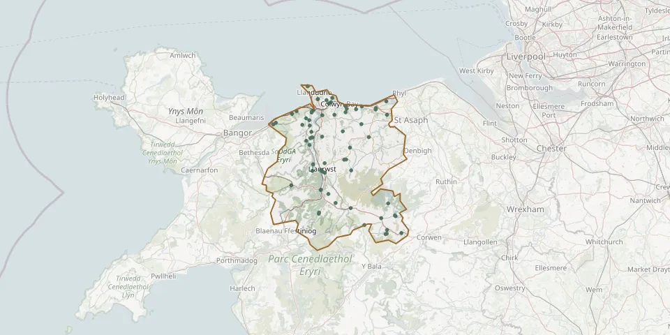 © OpenStreetMap
- Church of St Jerome, LlangwmGPS coordinates: 52.98882° N, 3.54052° W
- Conwy CemeteryGPS coordinates: 53.24579° N, 3.87297° W
- Dinmael CemeteryGPS coordinates: 52.99073° N, 3.48223° W
- Dwygyfylchi CemeteryGPS coordinates: 53.27831° N, 3.89521° W
- Eglwys Mynydd SeionGPS coordinates: 53.28299° N, 3.58349° W
- Erw Feiriol CemeteryGPS coordinates: 53.25103° N, 3.97665° W
- Erw Hedd CemeteryGPS coordinates: 53.09214° N, 3.79990° W
- Erw Rhun CemeteryGPS coordinates: 53.21504° N, 3.84064° W
- Henrhyd Congregational Chapel CemeteryGPS coordinates: 53.25726° N, 3.84511° W
- Llanbedr-y-cennin CemeteryGPS coordinates: 53.19817° N, 3.84427° W
- Llanfair Talhaiarn CemeteryGPS coordinates: 53.21673° N, 3.61110° W
- Llanfihangel Glyn Myfyr Burial GroundGPS coordinates: 53.03012° N, 3.50574° W
- Llangwm CemeteryGPS coordinates: 52.98791° N, 3.54484° W
- Llangwm CemeteryGPS coordinates: 52.99758° N, 3.53906° W
- LlangwstenynGPS coordinates: 53.33694° N, 3.85107° W
- Llanrhos CemeteryGPS coordinates: 53.33703° N, 3.85084° W
- Llanrwst CemeteryGPS coordinates: 53.13566° N, 3.79308° W
- Llanrwst Seion Calvinistic Methodist ChapelyardGPS coordinates: 53.13988° N, 3.79830° W
- Llysfaen CemeteryGPS coordinates: 53.28299° N, 3.66161° W
- Mynwent ArwelfaGPS coordinates: 53.03624° N, 3.80763° W
- Mynwent Cymuned EglwysbachGPS coordinates: 53.21806° N, 3.79459° W
- Mynwent FfoltGPS coordinates: 53.30404° N, 3.77768° W
- Mynwent Sant TudcludGPS coordinates: 53.03891° N, 3.80659° W
- Old Colwyn CemeteryGPS coordinates: 53.27578° N, 3.70246° W
- Old Colwyn (Saint Catherine) ChurchyardGPS coordinates: 53.29000° N, 3.70246° W
- Pandy Tudur CemeteryGPS coordinates: 53.16386° N, 3.70814° W
- Pandy Tudur CemeteryGPS coordinates: 53.16412° N, 3.70067° W
- Pentrefoelas Church CemeteryGPS coordinates: 53.04956° N, 3.68251° W
- Pentre-llyn-cymmer CemeteryGPS coordinates: 53.06023° N, 3.53511° W
- Rhandir Hedd CemeteryGPS coordinates: 53.24732° N, 3.98732° W