
Derbyshire
319 known cemeteries in Derbyshire, United Kingdom.
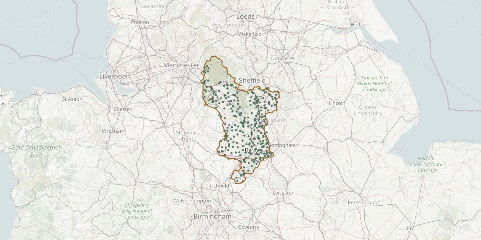 © OpenStreetMap
- St John the Baptist ChurchyardGPS coordinates: 53.25894° N, 1.91728° W
- Holy Cross Church, Upper LangwithGPS coordinates: 53.21872° N, 1.22450° W
- St John the Evangelist ChurchyardGPS coordinates: 53.32623° N, 1.39874° W
- St Margaret's Church, WormhillGPS coordinates: 53.26439° N, 1.81483° W
- St Marythe Virgin Church, DenbyGPS coordinates: 53.01401° N, 1.40704° W
- Ilkeston Stanton Road CemeteryGPS coordinates: 52.96460° N, 1.30830° W
- St Andrew ChurchyardGPS coordinates: 53.98642° N, 0.32272° W
- St John the Baptist at DronfieldGPS coordinates: 53.30166° N, 1.47205° W
- St Laurence ChurchyardGPS coordinates: 52.76134° N, 1.68198° W
- All Saints ChurchGPS coordinates: 53.19866° N, 1.33058° W
- Brimington CemeteryGPS coordinates: 53.25292° N, 1.40402° W
- Holy Cross Church, MortonGPS coordinates: 53.13659° N, 1.39315° W
- Long Eaton CemeteryGPS coordinates: 52.89866° N, 1.27854° W
- Chesterfield Boythorpe CemeteryGPS coordinates: 53.22722° N, 1.44303° W
- St. John the Baptist ChurchyardGPS coordinates: 53.14180° N, 1.64348° W
- All Saints ChurchyardGPS coordinates: 52.97708° N, 1.38347° W
- Little Longstone ChapelGPS coordinates: 53.24133° N, 1.72033° W
- Stoney Middleton CemeteryGPS coordinates: 53.27707° N, 1.65222° W
- St Thomas ChurchyardGPS coordinates: 53.23150° N, 1.45850° W
- All Saints Church Extension, Dale AbbeyGPS coordinates: 52.94619° N, 1.34565° W
- All Saints ChurchyardGPS coordinates: 53.16389° N, 1.48003° W
- Holy Trinity ChurchyardGPS coordinates: 53.13539° N, 1.51947° W
- Horsley (Saint Clement) ChurchyardGPS coordinates: 52.99649° N, 1.44211° W
- St Bartholomew's Church, HognastonGPS coordinates: 53.05198° N, 1.65041° W
- St. Helen's ChurchyardGPS coordinates: 53.29752° N, 1.63229° W
- St. James' ChurchyardGPS coordinates: 53.08583° N, 1.65650° W
- St. Luke's ChurchyardGPS coordinates: 53.05160° N, 1.45007° W
- St. Mary Old ChurchyardGPS coordinates: 53.22764° N, 1.29095° W
- St. Michael and All Angels ChurchyardGPS coordinates: 53.20065° N, 1.86574° W
- St Michaels ChurchyardGPS coordinates: 52.94630° N, 1.57470° W