
Derbyshire
319 known cemeteries in Derbyshire, United Kingdom.
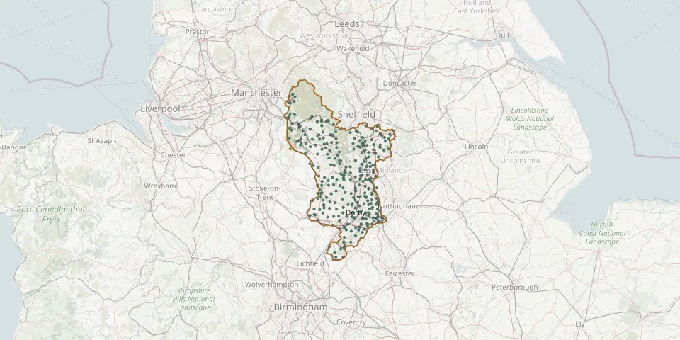 © OpenStreetMap
- St. Edmund King and Martyr ChurchyardGPS coordinates: 53.04868° N, 1.74114° W
- Steeple Arch Cemetery, WirksworthGPS coordinates: 53.09722° N, 1.56892° W
- St. George and St. Mary ChurchyardGPS coordinates: 52.75976° N, 1.56694° W
- St. George's ChurchyardGPS coordinates: 53.36586° N, 1.99409° W
- St. George's ChurchyardGPS coordinates: 52.81338° N, 1.48016° W
- St Giles Church, NormantonGPS coordinates: 52.89841° N, 1.48674° W
- St. Giles ChurchyardGPS coordinates: 52.93821° N, 1.80076° W
- St. Helen's ChurchyardGPS coordinates: 53.09045° N, 1.32436° W
- St James ChurchyardGPS coordinates: 52.86863° N, 1.35082° W
- St. James' ChurchyardGPS coordinates: 53.03775° N, 1.57566° W
- St. James' ChurchyardGPS coordinates: 53.03434° N, 1.37727° W
- St. James' ChurchyardGPS coordinates: 52.98111° N, 1.73161° W
- St. James' ChurchyardGPS coordinates: 52.85356° N, 1.44909° W
- St. James's ChurchyardGPS coordinates: 53.07025° N, 1.36187° W
- St James the Greater Churchyard, BarlboroughGPS coordinates: 53.28978° N, 1.28517° W
- St John's Church, AldercarGPS coordinates: 53.02668° N, 1.33600° W
- St. John's ChurchyardGPS coordinates: 52.94388° N, 1.72300° W
- St. John's ChurchyardGPS coordinates: 52.78253° N, 1.56857° W
- St John the Baptist ChurchyardGPS coordinates: 53.34686° N, 1.68970° W
- St. John the Baptist ChurchyardGPS coordinates: 52.91954° N, 1.73132° W
- St. John the Baptist ChurchyardGPS coordinates: 52.99303° N, 1.39614° W
- St. John The Baptist ChurchyardGPS coordinates: 53.28102° N, 1.27507° W
- St. John the Evangelist ChurchyardGPS coordinates: 53.01100° N, 1.51193° W
- St. John the Evangelist ChurchyardGPS coordinates: 53.43274° N, 1.99456° W
- St Katherines Church, RowsleyGPS coordinates: 53.19096° N, 1.62009° W
- St. Laurence ChurchyardGPS coordinates: 52.89850° N, 1.27100° W
- St Lawrence Church, HeanorGPS coordinates: 53.01353° N, 1.35192° W
- St. Leonard's ChurchyardGPS coordinates: 53.04853° N, 1.76829° W
- St Luke Church, Whaley ThornsGPS coordinates: 53.23438° N, 1.20375° W
- St. Margaret's ChapelGPS coordinates: 53.07698° N, 1.51806° W