
Durham
253 known cemeteries in Durham, United Kingdom.
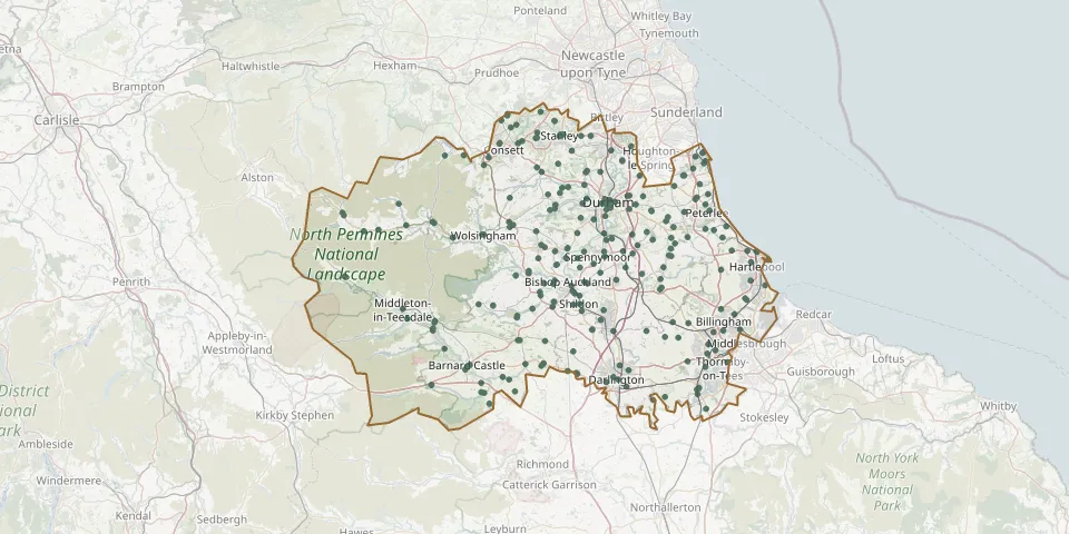 © OpenStreetMap
- Blackhall Cemetery, Blackhall RocksGPS coordinates: 54.74308° N, 1.28518° W
- Bowburn CemeteryGPS coordinates: 54.73167° N, 1.51672° W
- Bowes and Gilmonby CemeteryGPS coordinates: 54.51646° N, 2.01241° W
- Burnopfield, St James ChurchyardGPS coordinates: 54.90599° N, 1.74287° W
- Burtree Ford CemeteryGPS coordinates: 54.75879° N, 2.22867° W
- Castleside CemeteryGPS coordinates: 54.83008° N, 1.88349° W
- Chapel of EaseGPS coordinates: 54.60580° N, 2.00500° W
- Chilton CemeteryGPS coordinates: 54.66688° N, 1.55594° W
- Christ ChurchyardGPS coordinates: 54.83709° N, 1.54180° W
- Cockfield CemeteryGPS coordinates: 54.61562° N, 1.80042° W
- Coniscliffe (St Edwin) New ChurchyardGPS coordinates: 54.53387° N, 1.65541° W
- Cornforth Roman Catholic CemeteryGPS coordinates: 54.70793° N, 1.53952° W
- Cotherstone CemeteryGPS coordinates: 54.56809° N, 1.98049° W
- Cowshill, Copt Hill ChurchyardGPS coordinates: 54.76267° N, 2.23205° W
- Crook CemeteryGPS coordinates: 54.71348° N, 1.73283° W
- Dalton-le-Dale. Church of St AndrewGPS coordinates: 54.82550° N, 1.36650° W
- Darlington, Holy Trinity ChurchyardGPS coordinates: 54.52783° N, 1.56396° W
- Darlington West CemeteryGPS coordinates: 54.52050° N, 1.58110° W
- Deaf Hill CemeteryGPS coordinates: 54.72685° N, 1.42063° W
- Deaf Hill ChurchyardGPS coordinates: 54.71868° N, 1.41141° W
- Duncombe CemeteryGPS coordinates: 54.68453° N, 1.53374° W
- Durham CathedralGPS coordinates: 54.77311° N, 1.57624° W
- East Cemetery, DarlingtonGPS coordinates: 54.51405° N, 1.53212° W
- Egglescliffe CemeteryGPS coordinates: 54.51272° N, 1.35201° W
- Escomb CemeteryGPS coordinates: 54.66125° N, 1.71215° W
- Escomb ChurchyardGPS coordinates: 54.66581° N, 1.70841° W
- Etherley CemeteryGPS coordinates: 54.64444° N, 1.74312° W
- Fishburn CemeteryGPS coordinates: 54.68506° N, 1.43982° W
- Frosterley CemeteryGPS coordinates: 54.72693° N, 1.95903° W
- Gainford CemeteryGPS coordinates: 54.54414° N, 1.74178° W