
Lancashire
298 known cemeteries in Lancashire, United Kingdom.
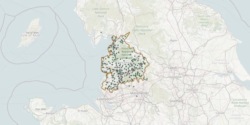 © OpenStreetMap
- St Eadmer Church, BleasdaleGPS coordinates: 53.90400° N, 2.65054° W
- St Gregory, Weld Bank Church CemeteryGPS coordinates: 53.63903° N, 2.63075° W
- St Helen ChurchyardGPS coordinates: 54.01116° N, 2.85530° W
- St. Helen's ChurchyardGPS coordinates: 53.87907° N, 2.79010° W
- St James ChurchGPS coordinates: 53.79289° N, 2.34653° W
- St James Church, BriercliffeGPS coordinates: 53.81084° N, 2.20253° W
- St James ChurchyardGPS coordinates: 53.70840° N, 2.32596° W
- St. James ChurchyardGPS coordinates: 53.55823° N, 2.85275° W
- St James the GreatGPS coordinates: 53.61682° N, 2.71757° W
- St John ChurchyardGPS coordinates: 53.82514° N, 2.28981° W
- St. John Old Churchyard ExtensionGPS coordinates: 54.17384° N, 2.82133° W
- St. John's CemeteryGPS coordinates: 53.79487° N, 2.31453° W
- St. John's ChurchyardGPS coordinates: 53.80888° N, 2.35856° W
- St. John’s ChurchyardGPS coordinates: 53.87417° N, 2.89593° W
- St Johns GraveyardGPS coordinates: 53.75065° N, 2.48165° W
- St. John the Baptist ChurchyardGPS coordinates: 53.67763° N, 2.79522° W
- St John The Baptist ChurchyardGPS coordinates: 54.14062° N, 2.63078° W
- St John The Baptist ChurchyardGPS coordinates: 54.15966° N, 2.59242° W
- St John the Baptist's ChurchGPS coordinates: 53.92899° N, 2.91145° W
- St. John the Divine ChurchyardGPS coordinates: 53.75336° N, 2.18951° W
- St John the Evangelist ChurchyardGPS coordinates: 53.68833° N, 2.64003° W
- St. Joseph Roman Catholic ChurchyardGPS coordinates: 53.84099° N, 2.48206° W
- St Joseph's AndertonGPS coordinates: 53.61701° N, 2.59403° W
- St. Joseph's Roman Catholic CemeteryGPS coordinates: 53.87707° N, 2.39600° W
- St. Joseph's Roman Catholic Church CemeteryGPS coordinates: 53.59233° N, 2.70102° W
- St Leonard ChurchyardGPS coordinates: 53.74765° N, 2.66670° W
- St Leonard ChurchyardGPS coordinates: 53.78601° N, 2.56094° W
- St Leonard Churchyard ExtensionGPS coordinates: 53.79918° N, 2.32220° W
- St. Leonard Old ChurchyardGPS coordinates: 53.81786° N, 2.45529° W
- St Margaret's ChurchyardGPS coordinates: 54.11140° N, 2.63620° W