
Leicestershire
305 known cemeteries in Leicestershire, United Kingdom.
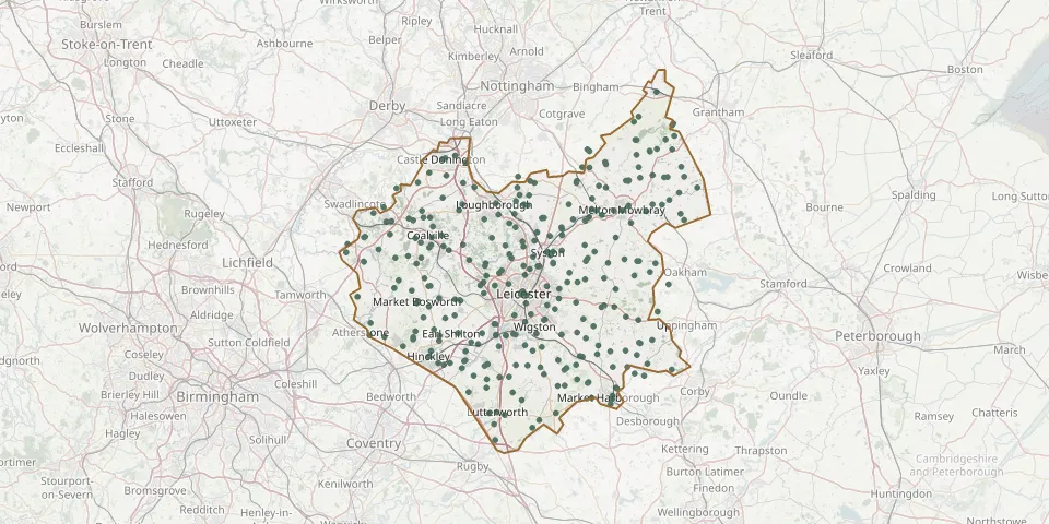 © OpenStreetMap
- Gilroes Cemetery and CrematoriumGPS coordinates: 52.65144° N, 1.17217° W
- Leicester (Welford Road) CemeteryGPS coordinates: 52.62201° N, 1.12818° W
- Blaby CemeteryGPS coordinates: 52.57402° N, 1.15410° W
- Barlestone CemeteryGPS coordinates: 52.64828° N, 1.37287° W
- Saffron Hill CemeteryGPS coordinates: 52.59341° N, 1.13100° W
- Loughborough CemeteryGPS coordinates: 52.75755° N, 1.19769° W
- St Philip and St James ChurchyardGPS coordinates: 52.64894° N, 1.24336° W
- Thorpe Road CemeteryGPS coordinates: 52.77066° N, 0.87082° W
- Measham CemeteryGPS coordinates: 52.70414° N, 1.49879° W
- St Michael and All Angels Church, DiseworthGPS coordinates: 52.81642° N, 1.32811° W
- Burbage CemeteryGPS coordinates: 52.52790° N, 1.33480° W
- Saint Denys ChurchyardGPS coordinates: 52.68275° N, 1.40351° W
- St. Helen's ChurchyardGPS coordinates: 52.89862° N, 0.85694° W
- Castle Donington CemeteryGPS coordinates: 52.84315° N, 1.33076° W
- Church of Saint JamesGPS coordinates: 52.60031° N, 1.38643° W
- Anstey CemeteryGPS coordinates: 52.66805° N, 1.19556° W
- St Giles Church, BarlestoneGPS coordinates: 52.64882° N, 1.36863° W
- Breedon on the Hill ChurchyardGPS coordinates: 52.80618° N, 1.39958° W
- All Saints Church, KniptonGPS coordinates: 52.87119° N, 0.77721° W
- Burton Lazars, St James ChurchyardGPS coordinates: 52.74469° N, 0.86437° W
- Saint James ChurchyardGPS coordinates: 52.62994° N, 1.34651° W
- Shepshed CemeteryGPS coordinates: 52.76405° N, 1.29631° W
- Broomleys CemeteryGPS coordinates: 52.72556° N, 1.34023° W
- Oadby CemeteryGPS coordinates: 52.59616° N, 1.08262° W
- Ashby De La Zouch CemeteryGPS coordinates: 52.74604° N, 1.47941° W
- Barkestone le Vale St Peter & St PaulGPS coordinates: 52.90626° N, 0.84502° W
- Hugglescote CemeteryGPS coordinates: 52.70670° N, 1.37181° W
- St. Edward King & Martyr ChurchyardGPS coordinates: 52.84170° N, 1.33830° W
- St Margaret ChurchyardGPS coordinates: 52.64034° N, 1.13634° W
- All Saints Church, RagdaleGPS coordinates: 52.77291° N, 1.02079° W