
Pembrokeshire
204 known cemeteries in Pembrokeshire, United Kingdom.
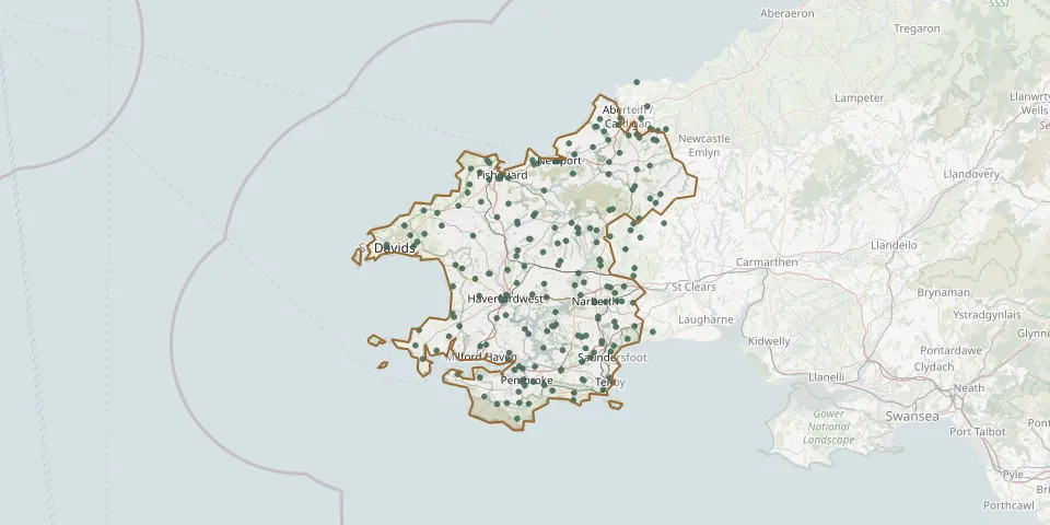 © OpenStreetMap
- Llanion CemeteryGPS coordinates: 51.69350° N, 4.92557° W
- St Martin's CemeteryGPS coordinates: 51.80235° N, 4.98050° W
- Saint Llawddog ChurchyardGPS coordinates: 52.05650° N, 4.63917° W
- Milford Haven CemeteryGPS coordinates: 51.72788° N, 5.03202° W
- Hermon Chapel Cemetery, FishguardGPS coordinates: 51.98840° N, 4.98679° W
- St Marys Church Cemetery, FishguardGPS coordinates: 51.98866° N, 4.96110° W
- Llanwnda CemeteryGPS coordinates: 52.01254° N, 5.00881° W
- Henllan Amgoed ChapelGPS coordinates: 51.84923° N, 4.64441° W
- St Brynach ChurchyardGPS coordinates: 52.02533° N, 4.79518° W
- Saint Elidyrs ChurchyardGPS coordinates: 51.73959° N, 4.66152° W
- Saint Issells CemeteryGPS coordinates: 51.71950° N, 4.70390° W
- Pentwer Cemetery, FishguardGPS coordinates: 51.98981° N, 4.98363° W
- Bethel Chapel, Llanddewi VelfreyGPS coordinates: 51.82121° N, 4.67118° W
- Carfan Independant Chapel, WhitlandGPS coordinates: 51.79542° N, 4.64829° W
- St Tygwydd's ChurchGPS coordinates: 52.06423° N, 4.56568° W
- St. Tyfei ChurchyardGPS coordinates: 51.66811° N, 4.87160° W
- Croescoch Baptist CemeteryGPS coordinates: 51.93477° N, 5.14008° W
- Tenby Town Council CemeteryGPS coordinates: 51.67965° N, 4.70717° W
- Cilfowyr ChapelGPS coordinates: 52.04846° N, 4.59659° W
- Ebenezer Baptist ChapelyardGPS coordinates: 51.71872° N, 4.74564° W
- Glandwr CemeteryGPS coordinates: 51.92607° N, 4.63315° W
- Cemetery near CrymychGPS coordinates: 52.03658° N, 4.74912° W
- Saint Davids ChurchyardGPS coordinates: 51.80828° N, 4.96631° W
- Roch CemeteryGPS coordinates: 51.84868° N, 5.07733° W
- Bryn Sion Chapel, Lampeter VelfreyGPS coordinates: 51.79823° N, 4.68868° W
- St Marys Church, BegellyGPS coordinates: 51.73266° N, 4.72678° W
- Pope Hill CemeteryGPS coordinates: 51.77157° N, 4.99024° W
- St Davids Church, WhitchurchGPS coordinates: 51.88390° N, 5.19866° W
- St Marys Church, ManorowenGPS coordinates: 51.98673° N, 5.00991° W
- Llwyn-yr-Hwrdd Independent Chapel, TegrynGPS coordinates: 51.96428° N, 4.57964° W