
Rhondda Cynon Taf
25 known cemeteries in Rhondda Cynon Taf, United Kingdom.
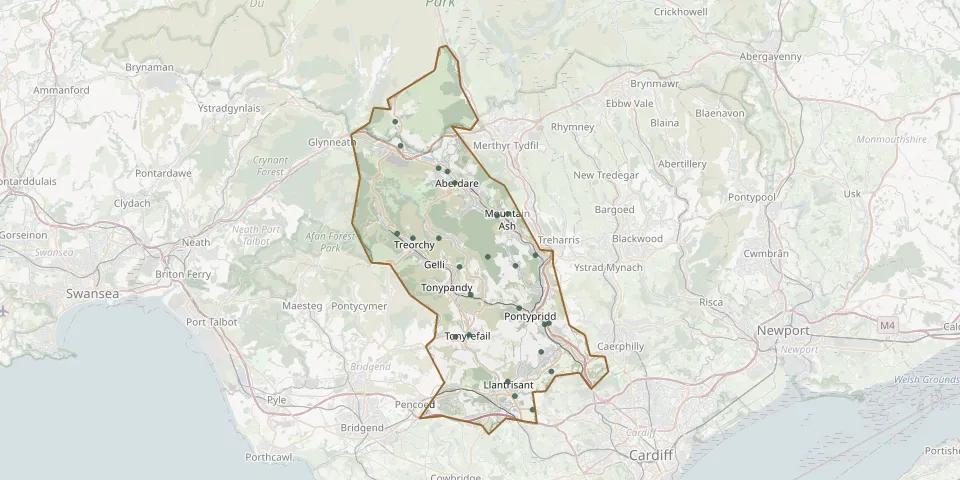 © OpenStreetMap
- Aberdare CemeteryGPS coordinates: 51.72607° N, 3.47116° W
- Treorchy CemeteryGPS coordinates: 51.66650° N, 3.50650° W
- Maes-yr-Arian CemeteryGPS coordinates: 51.68565° N, 3.39086° W
- Abercynon CemeteryGPS coordinates: 51.65223° N, 3.33809° W
- Aberffrwd CemeteryGPS coordinates: 51.68724° N, 3.37587° W
- Bryntirion Calvanistic Methodist ChapelyardGPS coordinates: 51.56964° N, 3.33020° W
- Bryn-Y-Gaer CemeteryGPS coordinates: 51.74530° N, 3.52350° W
- Capel RhonddaGPS coordinates: 51.60704° N, 3.36023° W
- Capel Y Ton Calvinistic Methodist ChapelyardGPS coordinates: 51.58406° N, 3.42920° W
- Cefn-Y-Parc Cemetery LlantrisantGPS coordinates: 51.53173° N, 3.36649° W
- Efail Isaf CemeteryGPS coordinates: 51.55299° N, 3.31606° W
- Ferndale CemeteryGPS coordinates: 51.66666° N, 3.47056° W
- Glyntaff CemeteryGPS coordinates: 51.59410° N, 3.31980° W
- Groes-faen CemeteryGPS coordinates: 51.52026° N, 3.34225° W
- Penderyn CemeteryGPS coordinates: 51.76554° N, 3.53062° W
- Penrhys CemeteryGPS coordinates: 51.64205° N, 3.44258° W
- Penuel CemeteryGPS coordinates: 51.54448° N, 3.37587° W
- Saint Gwynno ChurchyardGPS coordinates: 51.65082° N, 3.40362° W
- Saint John the Baptist ChurchGPS coordinates: 51.71383° N, 3.44874° W
- St. Fagan ChurchyardGPS coordinates: 51.72328° N, 3.45908° W
- Trane CemeteryGPS coordinates: 51.58260° N, 3.44768° W
- Trealaw CemeteryGPS coordinates: 51.61840° N, 3.42690° W
- Treforest CemeteryGPS coordinates: 51.59309° N, 3.32570° W
- Treorchy CemeteryGPS coordinates: 51.67063° N, 3.52804° W
- Ynysybwl CemeteryGPS coordinates: 51.64299° N, 3.36543° W