
Warwickshire
234 known cemeteries in Warwickshire, United Kingdom.
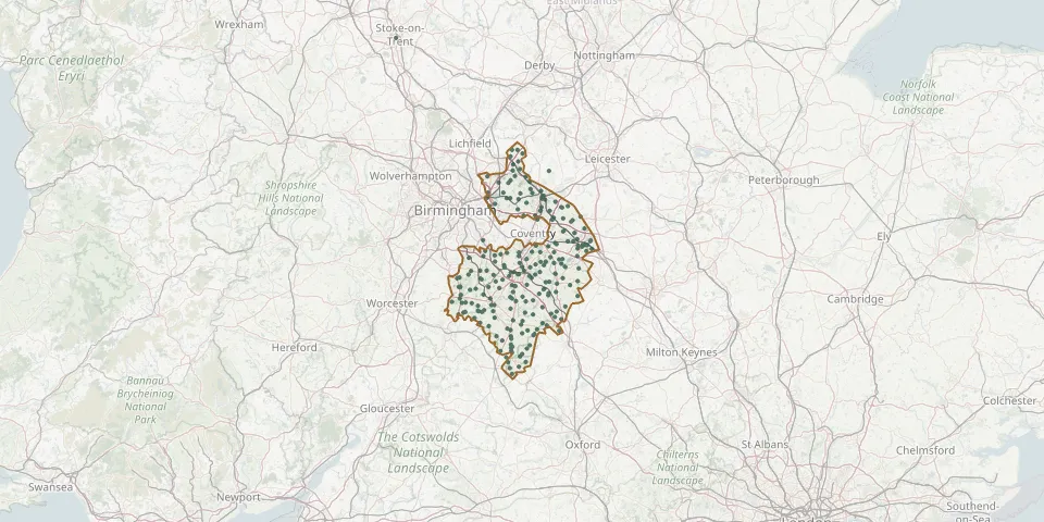 © OpenStreetMap
- St Peter & St Paul Churchyard, Water Orton.GPS coordinates: 52.51741° N, 1.74071° W
- Stratford Upon Avon CemeteryGPS coordinates: 52.18675° N, 1.72200° W
- St. Thomas Becket CemeteryGPS coordinates: 52.03424° N, 1.56578° W
- St Wilfreds Parish ChurchyardGPS coordinates: 52.51259° N, 1.58465° W
- Sun Rising Natural Burial Ground and Nature ReserveGPS coordinates: 52.11070° N, 1.48969° W
- Sutton-under-Brailes CemeteryGPS coordinates: 52.02708° N, 1.57632° W
- Tanworth in Arden (Saint Mary Magdalene) ChurchyardGPS coordinates: 52.33248° N, 1.83486° W
- The Old Cemetery, Birmingham RoadGPS coordinates: 52.21732° N, 1.87471° W
- Tysoe Church CemeteryGPS coordinates: 52.09332° N, 1.50895° W
- Ufton CemeteryGPS coordinates: 52.25651° N, 1.44671° W
- Union Place Church graveyardGPS coordinates: 52.45325° N, 1.48670° W
- Warton CemeteryGPS coordinates: 52.62916° N, 1.58486° W
- Warwick (Saint Mary) Collegiate ChurchyardGPS coordinates: 52.28202° N, 1.58792° W
- Welford on Avon Churchyard ExtensionGPS coordinates: 52.16709° N, 1.78611° W
- Whatcote CemeteryGPS coordinates: 52.09837° N, 1.56521° W
- Whitnash Cemetery ExtensionGPS coordinates: 52.27073° N, 1.51810° W
- Widney Manor CemeteryGPS coordinates: 52.38690° N, 1.76310° W
- Willey CemeteryGPS coordinates: 52.45898° N, 1.27070° W
- Wilmcote CemeteryGPS coordinates: 52.21910° N, 1.76217° W
- Winderton CemeteryGPS coordinates: 52.06159° N, 1.52708° W
- Withybrook CemeteryGPS coordinates: 52.45350° N, 1.35860° W
- Wolvey CemeteryGPS coordinates: 52.48691° N, 1.36429° W
- Woodlands Cemetery and CrematoriumGPS coordinates: 52.49186° N, 1.73063° W
- Wroxall CemeteryGPS coordinates: 52.34285° N, 1.67366° W