
West Lothian
27 known cemeteries in West Lothian, United Kingdom.
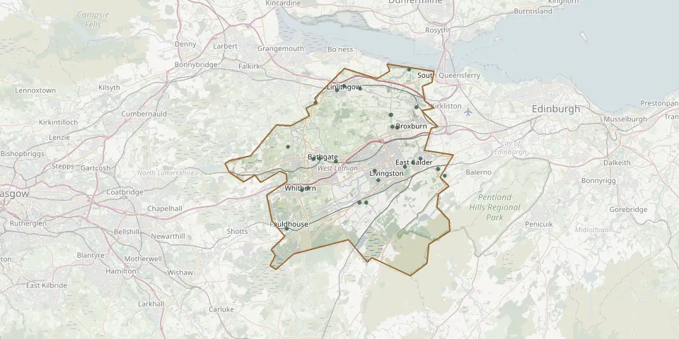 © OpenStreetMap
- St Cuthbert's Kirk and Kirkyard - Historical LandmarkGPS coordinates: 55.89460° N, 3.46624° W
- Linlithgow CemeteryGPS coordinates: 55.97336° N, 3.61415° W
- Winchburgh CemeteryGPS coordinates: 55.95476° N, 3.45982° W
- Kirkton OldGPS coordinates: 55.89580° N, 3.61650° W
- Old Parish Church, LivingstonGPS coordinates: 55.88547° N, 3.54095° W
- Boghead CemeteryGPS coordinates: 55.89850° N, 3.65990° W
- Uphall Old CemeteryGPS coordinates: 55.93253° N, 3.49739° W
- Bathgate CemeteryGPS coordinates: 55.89891° N, 3.64814° W
- Abercorn CemeteryGPS coordinates: 55.99570° N, 3.47390° W
- Adambrae CemeteryGPS coordinates: 55.87527° N, 3.53384° W
- Kirk of CalderGPS coordinates: 55.89007° N, 3.48210° W
- Woodbank Cemetery WoodendGPS coordinates: 55.91168° N, 3.70911° W
- Uphall CemeteryGPS coordinates: 55.94667° N, 3.50857° W
- Kingscavil CemeteryGPS coordinates: 55.97510° N, 3.56920° W
- St. Nicholas ChurchyardGPS coordinates: 55.93369° N, 3.50653° W
- Hermand Park CemeteryGPS coordinates: 55.85080° N, 3.55727° W
- Kirknewton CemeteryGPS coordinates: 55.88763° N, 3.41811° W
- Linlithgow Palace CemeteryGPS coordinates: 55.97790° N, 3.60040° W
- West Calder Auld KirkGPS coordinates: 55.85101° N, 3.57076° W
- Almondell Cemetery, East CalderGPS coordinates: 55.89894° N, 3.45208° W
- St Machan’s ChurchGPS coordinates: 55.94637° N, 3.51029° W
- Blaeberry CemeteryGPS coordinates: 55.86683° N, 3.67069° W
- Cemetery near LinlithgowGPS coordinates: 55.95965° N, 3.65564° W
- East Calder Churchyard CemeteryGPS coordinates: 55.88742° N, 3.41755° W
- Fauldhouse CemeteryGPS coordinates: 55.82248° N, 3.71162° W
- Maconochie Burial GroundGPS coordinates: 55.88026° N, 3.40478° W
- Whitburn South Parish Church CemeteryGPS coordinates: 55.86455° N, 3.68212° W