
West Midlands
174 known cemeteries in West Midlands, United Kingdom.
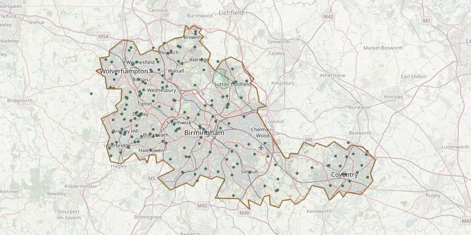 © OpenStreetMap
- Christ ChurchyardGPS coordinates: 52.54635° N, 2.07986° W
- Church of Saint Augustine of HippoGPS coordinates: 52.49997° N, 2.10883° W
- Coseley Unitarian Meeting HouseGPS coordinates: 52.54304° N, 2.08376° W
- Cradley Park Lane Unitarian ChapelGPS coordinates: 52.46358° N, 2.09719° W
- Danescourt CemeteryGPS coordinates: 52.60430° N, 2.17830° W
- Darkhouse Baptist Chapel CemeteryGPS coordinates: 52.54957° N, 2.08349° W
- Dudley CemeteryGPS coordinates: 52.46293° N, 2.14866° W
- Eastern Green Church GraveyardGPS coordinates: 52.41971° N, 1.60174° W
- Erdington Greek Orthodox ChurchyardGPS coordinates: 52.52678° N, 1.83697° W
- Essington CemeteryGPS coordinates: 52.62425° N, 2.04619° W
- Former King Street United Reformed Church GraveyardGPS coordinates: 52.50883° N, 2.08362° W
- Former St. James' CemeteryGPS coordinates: 52.51426° N, 2.09208° W
- Fox Hollies CemeteryGPS coordinates: 52.43402° N, 1.83999° W
- Garretts Green CemeteryGPS coordinates: 52.45961° N, 1.77822° W
- Gornal Wood Cemetery and CrematoriumGPS coordinates: 52.51137° N, 2.13401° W
- Great Charles Street CemeteryGPS coordinates: 52.64774° N, 1.92776° W
- Halesowen CemeteryGPS coordinates: 52.45008° N, 2.05354° W
- Hall Green CemeteryGPS coordinates: 52.55256° N, 2.07287° W
- Handsworth CemeteryGPS coordinates: 52.50511° N, 1.94841° W
- Handsworth CemeteryGPS coordinates: 52.51440° N, 1.95790° W
- Heath Lane CemeteryGPS coordinates: 52.53558° N, 1.98856° W
- Holly Lane CemeteryGPS coordinates: 52.49354° N, 1.98827° W
- Holy Trinity ChurchGPS coordinates: 52.48024° N, 2.15887° W
- Holy Trinity ChurchyardGPS coordinates: 52.56419° N, 1.82163° W
- Holy Trinity Churchyard ShortheathGPS coordinates: 52.60472° N, 2.03642° W
- James Bridge CemeteryGPS coordinates: 52.57700° N, 2.01920° W
- Key Hill CemeteryGPS coordinates: 52.49084° N, 1.91586° W
- Kings Norton CemeteryGPS coordinates: 52.39746° N, 1.92277° W
- Knowle Parish ChurchyardGPS coordinates: 52.38849° N, 1.73360° W
- Lentons Lane CemeteryGPS coordinates: 52.44760° N, 1.44695° W