
Yorkshire
249 known cemeteries in Yorkshire, United Kingdom.
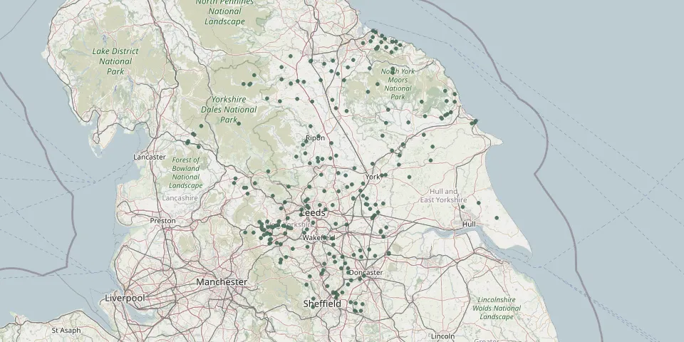 © OpenStreetMap
- Balby, War MemorialGPS coordinates: 53.50720° N, 1.15046° W
- Bethel Chapel CemeteryGPS coordinates: 53.91022° N, 2.07496° W
- Bethel Methodist ChapelyardGPS coordinates: 53.75635° N, 1.80799° W
- Bethel Methodist New Connexion ChapelGPS coordinates: 53.65853° N, 1.87114° W
- Booth Congregational United Reform ChapelyardGPS coordinates: 53.74420° N, 1.93793° W
- Botton Village CemeteryGPS coordinates: 54.42900° N, 0.92827° W
- Bradley CemeteryGPS coordinates: 53.93068° N, 1.99071° W
- Bramley Baptist ChurchyardGPS coordinates: 53.81007° N, 1.63108° W
- Brierley CemeteryGPS coordinates: 53.59438° N, 1.38123° W
- Brompton-On-Swale CemeteryGPS coordinates: 54.39174° N, 1.66089° W
- Butts Green Baptist ChapelyardGPS coordinates: 53.72144° N, 1.93408° W
- Campsall New CemeteryGPS coordinates: 53.62391° N, 1.18005° W
- Campsall Old CemeteryGPS coordinates: 53.62410° N, 1.18010° W
- Catterick Garrison Military CemeteryGPS coordinates: 54.38031° N, 1.71383° W
- Cawood CemeteryGPS coordinates: 53.83562° N, 1.13490° W
- Charlestown CemeteryGPS coordinates: 53.84371° N, 1.75957° W
- Christ Church ChurchyardGPS coordinates: 54.61700° N, 1.08066° W
- Christ ChurchyardGPS coordinates: 53.90970° N, 2.05786° W
- Cleckheaton New CemeteryGPS coordinates: 53.72989° N, 1.74001° W
- Cleckheaton Old CemeteryGPS coordinates: 53.72611° N, 1.72130° W
- Clifton CemeteryGPS coordinates: 53.70226° N, 1.75837° W
- Cloughton Church CemeteryGPS coordinates: 54.33225° N, 0.45119° W
- Croft-on-Tees CemeteryGPS coordinates: 54.47936° N, 1.56200° W
- Denaby CemeteryGPS coordinates: 53.48711° N, 1.24822° W
- Dunnington CemeteryGPS coordinates: 53.96751° N, 0.98238° W
- East Herringthorpe Cemetery and Rotherham CrematoriumGPS coordinates: 53.43169° N, 1.31581° W
- East Keswick - St Mary MagdaleneGPS coordinates: 53.89490° N, 1.45486° W
- Ebenezer Methodist ChapelyardGPS coordinates: 53.68048° N, 1.94461° W
- Edlington CemeteryGPS coordinates: 53.49274° N, 1.18104° W
- Free United Methodist ChapelGPS coordinates: 53.70298° N, 1.89468° W