
Kansas
2,523 known cemeteries in Kansas, United States.
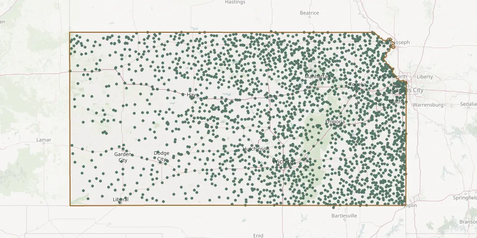 © OpenStreetMap
- Arvonia CemeteryGPS coordinates: 38.48586° N, 95.89599° W
- Ascension CemeteryGPS coordinates: 37.76884° N, 97.25259° W
- Asherville CemeteryGPS coordinates: 39.41993° N, 97.96676° W
- Ashland CemeteryGPS coordinates: 39.11021° N, 96.61567° W
- Ashton CemeteryGPS coordinates: 38.68154° N, 97.13225° W
- Ash Valley CemeteryGPS coordinates: 38.29079° N, 99.21716° W
- Askren CemeteryGPS coordinates: 37.97386° N, 95.83774° W
- Assaria Lutheran Church CemeteryGPS coordinates: 38.68230° N, 97.60373° W
- Athelstane CemeteryGPS coordinates: 39.17690° N, 97.17530° W
- Athens CemeteryGPS coordinates: 39.61045° N, 98.30248° W
- Atlanta CemeteryGPS coordinates: 37.43278° N, 96.76052° W
- Attebery CemeteryGPS coordinates: 37.15133° N, 97.43872° W
- Attica CemeteryGPS coordinates: 37.23854° N, 98.24569° W
- Atwater CemeteryGPS coordinates: 37.14086° N, 100.45028° W
- Atwood Fairview CemeteryGPS coordinates: 39.80638° N, 101.05791° W
- Aubry CemeteryGPS coordinates: 38.78136° N, 94.67063° W
- Auburn CemeteryGPS coordinates: 38.90871° N, 95.83465° W
- Ault CemeteryGPS coordinates: 39.90049° N, 100.32813° W
- Aurora CemeteryGPS coordinates: 39.27770° N, 99.08477° W
- Austin CemeteryGPS coordinates: 37.34558° N, 97.51325° W
- Avilla CemeteryGPS coordinates: 37.12720° N, 99.35080° W
- Avondale CemeteryGPS coordinates: 37.95360° N, 94.81390° W
- Bachelder CemeteryGPS coordinates: 37.49420° N, 95.85690° W
- Badger Creek CemeteryGPS coordinates: 38.40500° N, 96.05830° W
- Bailey CemeteryGPS coordinates: 38.23587° N, 95.83705° W
- Baileyville CemeteryGPS coordinates: 39.84254° N, 96.19758° W
- Bainum CemeteryGPS coordinates: 37.87725° N, 98.27063° W
- Baird CemeteryGPS coordinates: 37.27890° N, 98.25670° W
- Baird CemeteryGPS coordinates: 38.31780° N, 95.48830° W
- Baker CemeteryGPS coordinates: 38.19884° N, 95.82402° W