
Kentucky
5,785 known cemeteries in Kentucky, United States.
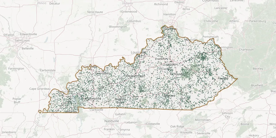 © OpenStreetMap
- 1565 Rabbit Ridge RoadGPS coordinates: 36.99695° N, 87.14744° W
- Aaron Barrier CemeteryGPS coordinates: 36.76884° N, 84.77202° W
- Aaron Farra Family CemeteryGPS coordinates: 37.94067° N, 84.54926° W
- Aarons Chapel CemeteryGPS coordinates: 36.79048° N, 85.15246° W
- Abbott-Sturgill CemeteryGPS coordinates: 38.22408° N, 83.32012° W
- Abe Collins CemeteryGPS coordinates: 37.16146° N, 83.78114° W
- Aberdeen Baptist Church CemeteryGPS coordinates: 37.25592° N, 86.67948° W
- Abney CemeteryGPS coordinates: 37.51576° N, 84.26918° W
- Abraham Keeton CemeteryGPS coordinates: 37.78419° N, 83.15372° W
- Abrahams CemeteryGPS coordinates: 37.45411° N, 84.58204° W
- Abron CemeteryGPS coordinates: 37.45425° N, 84.58161° W
- Absher CemeteryGPS coordinates: 37.17280° N, 85.24170° W
- Achers CemeteryGPS coordinates: 38.01696° N, 85.81870° W
- Ackman CemeteryGPS coordinates: 38.52924° N, 84.53022° W
- Acra CemeteryGPS coordinates: 38.98589° N, 84.75050° W
- Adaburg Baptist Church CemeteryGPS coordinates: 37.59168° N, 86.85249° W
- Adams CemeteryGPS coordinates: 37.73120° N, 83.17184° W
- Adams CemeteryGPS coordinates: 38.35478° N, 83.40532° W
- Adams CemeteryGPS coordinates: 37.94280° N, 84.10170° W
- Adams CemeteryGPS coordinates: 37.84841° N, 84.08770° W
- Adams CemeteryGPS coordinates: 38.90889° N, 84.48611° W
- Adams CemeteryGPS coordinates: 36.91692° N, 87.81239° W
- Adams CemeteryGPS coordinates: 37.07171° N, 87.56167° W
- Adams CemeteryGPS coordinates: 38.10370° N, 82.79461° W
- Adams CemeteryGPS coordinates: 37.75315° N, 83.04045° W
- Adams CemeteryGPS coordinates: 37.71136° N, 82.98652° W
- Adams CemeteryGPS coordinates: 36.54825° N, 88.71135° W
- Adams CemeteryGPS coordinates: 37.13692° N, 82.79439° W
- Adams CemeteryGPS coordinates: 37.81065° N, 83.03934° W
- Adams CemeteryGPS coordinates: 37.71418° N, 83.65319° W