
Nebraska
1,553 known cemeteries in Nebraska, United States.
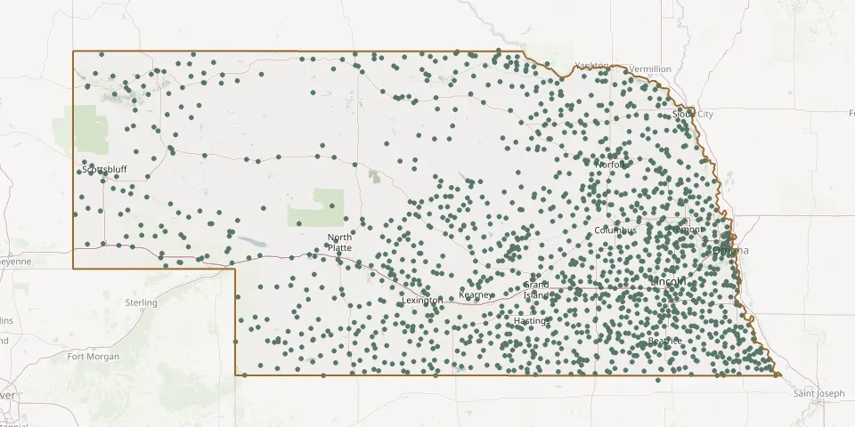 © OpenStreetMap
- Salem CemeteryGPS coordinates: 41.92069° N, 96.96121° W
- Salem CemeteryGPS coordinates: 40.23420° N, 98.38560° W
- Salem CemeteryGPS coordinates: 40.82142° N, 97.92098° W
- Salem CemeteryGPS coordinates: 41.30812° N, 103.04194° W
- Salem CemeteryGPS coordinates: 41.80062° N, 96.55018° W
- Salem CemeteryGPS coordinates: 40.12560° N, 98.06580° W
- Salem East CemeteryGPS coordinates: 40.49754° N, 99.98022° W
- Salem Evangelical Church CemeteryGPS coordinates: 41.49002° N, 98.92469° W
- Salem Lutheran CemeteryGPS coordinates: 40.49668° N, 99.98911° W
- Sanders CemeteryGPS coordinates: 41.40860° N, 103.21580° W
- Sandstrom CemeteryGPS coordinates: 40.59823° N, 99.56726° W
- Sand Valley CemeteryGPS coordinates: 41.27734° N, 100.02487° W
- Saron CemeteryGPS coordinates: 40.61085° N, 97.92993° W
- Saronville United Methodist CemeteryGPS coordinates: 40.61489° N, 97.91862° W
- Saunders County Poor Farm CemeteryGPS coordinates: 41.24738° N, 96.60935° W
- Schroeder CemeteryGPS coordinates: 41.59721° N, 97.09711° W
- Schultz CemeteryGPS coordinates: 40.76986° N, 96.56031° W
- Schuyler CemeteryGPS coordinates: 41.44183° N, 97.07367° W
- Scottish Cemetery, St PaulGPS coordinates: 41.19166° N, 98.61345° W
- Scottville CemeteryGPS coordinates: 42.68335° N, 98.51203° W
- Scribner Municipal CemeteryGPS coordinates: 41.65552° N, 96.69164° W
- Seaton CemeteryGPS coordinates: 40.75692° N, 98.08766° W
- Sells Valley CemeteryGPS coordinates: 41.16250° N, 100.09280° W
- Seneca CemeteryGPS coordinates: 42.03664° N, 100.83356° W
- Servants of Mary CemeteryGPS coordinates: 41.30149° N, 96.02580° W
- Seward CemeteryGPS coordinates: 40.92953° N, 97.09936° W
- Shaw CemeteryGPS coordinates: 40.43030° N, 99.57810° W
- Shell Creek CemeteryGPS coordinates: 41.77181° N, 97.76515° W
- Shelton CemeteryGPS coordinates: 40.77261° N, 98.71365° W
- Sheridan CemeteryGPS coordinates: 40.39376° N, 95.85965° W