
Oklahoma
2,710 known cemeteries in Oklahoma, United States.
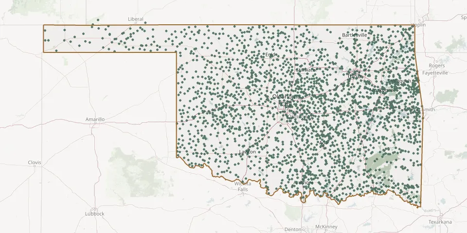 © OpenStreetMap
- Burbank CemeteryGPS coordinates: 36.70051° N, 96.74329° W
- Burgess CemeteryGPS coordinates: 34.92314° N, 96.55334° W
- Burney CemeteryGPS coordinates: 33.86503° N, 96.32028° W
- Burneyville CemeteryGPS coordinates: 33.90570° N, 97.28673° W
- Burris CemeteryGPS coordinates: 34.65920° N, 95.58720° W
- Busby CemeteryGPS coordinates: 36.90444° N, 95.92416° W
- Busch Chapel CemeteryGPS coordinates: 36.69610° N, 100.50670° W
- Butler CemeteryGPS coordinates: 35.64455° N, 99.19871° W
- Butler CemeteryGPS coordinates: 34.28108° N, 95.95295° W
- Butler CemeteryGPS coordinates: 36.54308° N, 94.72826° W
- Butler Creek CemeteryGPS coordinates: 35.60216° N, 95.43080° W
- Butner CemeteryGPS coordinates: 35.26780° N, 96.43690° W
- Butterly CemeteryGPS coordinates: 34.50814° N, 97.17394° W
- Buzzard CemeteryGPS coordinates: 36.61191° N, 94.80071° W
- Byars CemeteryGPS coordinates: 34.86780° N, 97.03712° W
- Byrds Prairie CemeteryGPS coordinates: 34.57920° N, 96.41220° W
- Byrms CemeteryGPS coordinates: 33.72823° N, 94.59160° W
- Byron-Amorita CemeteryGPS coordinates: 36.92042° N, 98.31492° W
- Cabaniss CemeteryGPS coordinates: 35.54817° N, 99.03782° W
- Cache CemeteryGPS coordinates: 34.62770° N, 98.57951° W
- Cache CemeteryGPS coordinates: 35.25361° N, 94.82167° W
- Cache Creek CemeteryGPS coordinates: 34.88669° N, 98.44096° W
- Cache Creek Mission CemeteryGPS coordinates: 34.88748° N, 98.44416° W
- Cache Kiowa Comanche Apache Intertribal CemeteryGPS coordinates: 34.62138° N, 98.65639° W
- Caddo CemeteryGPS coordinates: 34.12788° N, 96.25134° W
- Caddo Mennonite Brethren CemeteryGPS coordinates: 35.34835° N, 98.55989° W
- Cairo CemeteryGPS coordinates: 34.58810° N, 96.10830° W
- Calumet CemeteryGPS coordinates: 35.60649° N, 98.13572° W
- Calvary Catholic CemeteryGPS coordinates: 36.42109° N, 97.87903° W
- Calvary CemeteryGPS coordinates: 34.92906° N, 95.74245° W