
Oklahoma
2,710 known cemeteries in Oklahoma, United States.
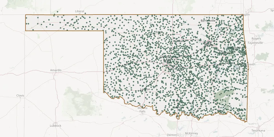 © OpenStreetMap
- Cordell CemeteryGPS coordinates: 35.30394° N, 98.96536° W
- Corinne CemeteryGPS coordinates: 34.18640° N, 95.29920° W
- Corley CemeteryGPS coordinates: 34.72322° N, 96.96659° W
- Cornish CemeteryGPS coordinates: 34.14434° N, 97.61162° W
- Corum CemeteryGPS coordinates: 34.36970° N, 98.12220° W
- Cosmos CemeteryGPS coordinates: 36.96572° N, 101.91096° W
- Cottonwood CemeteryGPS coordinates: 34.63780° N, 99.62030° W
- Cottonwood CemeteryGPS coordinates: 35.36300° N, 94.54991° W
- Cottonwood CemeteryGPS coordinates: 35.95610° N, 98.34235° W
- Council Creek CemeteryGPS coordinates: 35.08673° N, 97.12531° W
- Council Hill CemeteryGPS coordinates: 35.55276° N, 95.66993° W
- Council House CemeteryGPS coordinates: 36.68694° N, 94.65806° W
- County Home CemeteryGPS coordinates: 36.29560° N, 95.32390° W
- Countyline CemeteryGPS coordinates: 34.38890° N, 95.04720° W
- County Line CemeteryGPS coordinates: 34.66708° N, 94.93724° W
- Covington Community CemeteryGPS coordinates: 36.29678° N, 97.58734° W
- Cowboy Hill CemeteryGPS coordinates: 36.60675° N, 97.13847° W
- Cowlington CemeteryGPS coordinates: 35.31065° N, 94.77782° W
- Coy CemeteryGPS coordinates: 36.97217° N, 99.30297° W
- Coyle CemeteryGPS coordinates: 35.96433° N, 97.25536° W
- Cramp CemeteryGPS coordinates: 35.36390° N, 95.19030° W
- Creek County Poor Farm CemeteryGPS coordinates: 35.81789° N, 96.44042° W
- Creek Mine CemeteryGPS coordinates: 35.42066° N, 96.01361° W
- Crescent CemeteryGPS coordinates: 35.95850° N, 97.56780° W
- Crestwood CemeteryGPS coordinates: 35.34037° N, 96.12528° W
- Criner CemeteryGPS coordinates: 34.08996° N, 97.20970° W
- Crittenden CemeteryGPS coordinates: 35.99203° N, 94.53328° W
- Crittenden CemeteryGPS coordinates: 36.14008° N, 94.73634° W
- Crittenden CemeteryGPS coordinates: 35.92969° N, 95.03532° W
- Cropper CemeteryGPS coordinates: 35.03007° N, 97.15891° W