
Oklahoma
2,710 known cemeteries in Oklahoma, United States.
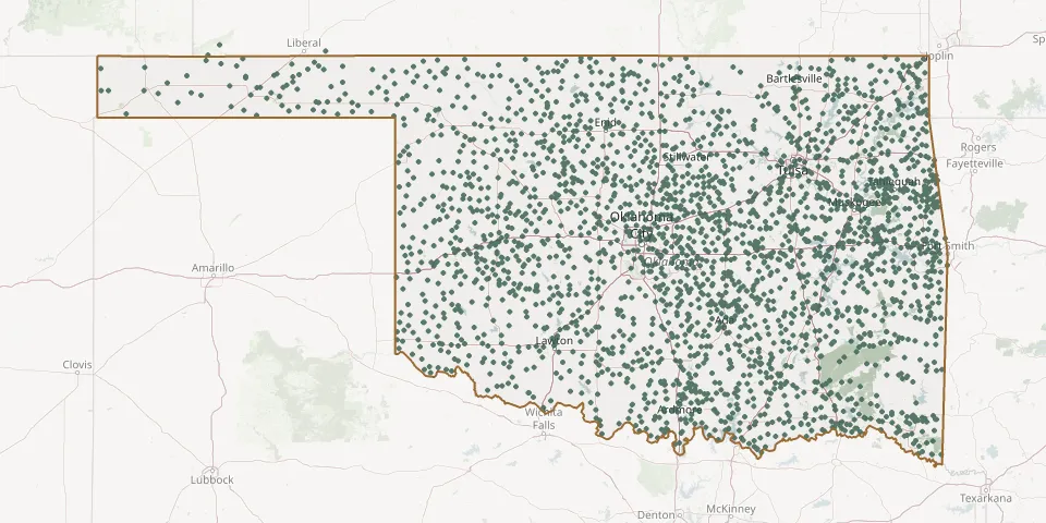 © OpenStreetMap
- Smallpox CemeteryGPS coordinates: 34.96499° N, 99.36724° W
- Smith and Messer CemeteryGPS coordinates: 35.70900° N, 96.73500° W
- Smith CemeteryGPS coordinates: 36.70888° N, 97.71390° W
- Smith CemeteryGPS coordinates: 34.64440° N, 95.60420° W
- Smith CemeteryGPS coordinates: 36.10495° N, 95.73535° W
- Smith CemeteryGPS coordinates: 35.30563° N, 97.49369° W
- Smithville CemeteryGPS coordinates: 34.46515° N, 94.63875° W
- Snake Bend CemeteryGPS coordinates: 35.65170° N, 99.61470° W
- Snake Creek CemeteryGPS coordinates: 35.88441° N, 95.85470° W
- Snake Creek CemeteryGPS coordinates: 35.34050° N, 96.61770° W
- Snake Creek Indian Baptist Church CemeteryGPS coordinates: 35.84816° N, 95.87832° W
- Snell CemeteryGPS coordinates: 36.53810° N, 94.69330° W
- Snider CemeteryGPS coordinates: 36.53967° N, 95.40448° W
- Sobol CemeteryGPS coordinates: 34.15065° N, 95.20866° W
- Sod CemeteryGPS coordinates: 35.32093° N, 99.01196° W
- Solf CemeteryGPS coordinates: 36.53500° N, 98.42530° W
- Soper CemeteryGPS coordinates: 34.03391° N, 95.70546° W
- Sophia CemeteryGPS coordinates: 36.55000° N, 100.43220° W
- Sorge CemeteryGPS coordinates: 36.30470° N, 98.30030° W
- South Bethel CemeteryGPS coordinates: 35.64184° N, 95.23477° W
- South Bethel East CemeteryGPS coordinates: 35.64182° N, 95.23335° W
- South Burns CemeteryGPS coordinates: 35.26262° N, 99.16156° W
- South Cedar CemeteryGPS coordinates: 35.49420° N, 98.79940° W
- South Community CemeteryGPS coordinates: 35.21710° N, 96.22229° W
- South Heights CemeteryGPS coordinates: 35.97614° N, 96.10933° W
- South Indian CemeteryGPS coordinates: 36.29033° N, 96.81714° W
- South Lutheran CemeteryGPS coordinates: 35.94429° N, 97.29963° W
- South Mennonite Brethren CemeteryGPS coordinates: 36.23091° N, 98.43221° W
- South Persimmon CemeteryGPS coordinates: 36.22766° N, 99.34851° W
- South Side CemeteryGPS coordinates: 35.94830° N, 96.60720° W