
Oklahoma
2,710 known cemeteries in Oklahoma, United States.
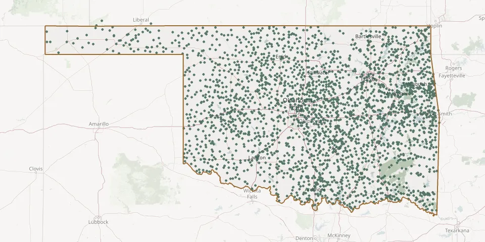 © OpenStreetMap
- Woodland CemeteryGPS coordinates: 36.31984° N, 96.47355° W
- Woodlawn CemeteryGPS coordinates: 36.30347° N, 95.60278° W
- Woodlawn CemeteryGPS coordinates: 35.60133° N, 95.95708° W
- Woodlawn CemeteryGPS coordinates: 34.72426° N, 98.06352° W
- Woodman CemeteryGPS coordinates: 34.53447° N, 96.19998° W
- Woods Memorial CemeteryGPS coordinates: 34.90953° N, 98.05907° W
- Woodville CemeteryGPS coordinates: 33.93928° N, 96.63873° W
- Woolsey CemeteryGPS coordinates: 34.32064° N, 97.82448° W
- Worley CemeteryGPS coordinates: 35.39218° N, 97.35376° W
- Worster CemeteryGPS coordinates: 35.84906° N, 94.96498° W
- Wright CemeteryGPS coordinates: 35.71803° N, 96.87678° W
- Wyandotte Indian CemeteryGPS coordinates: 36.80656° N, 94.72096° W
- Wyatt CemeteryGPS coordinates: 35.01249° N, 98.91910° W
- Wynnewood View CemeteryGPS coordinates: 34.57874° N, 97.19567° W
- Yake CemeteryGPS coordinates: 35.95949° N, 99.24816° W
- Yarbrough CemeteryGPS coordinates: 33.86560° N, 96.58250° W
- Yardeka Indian Baptist Church CemeteryGPS coordinates: 35.36533° N, 95.92298° W
- Yarnaby CemeteryGPS coordinates: 33.78813° N, 96.27056° W
- Yashau CemeteryGPS coordinates: 34.04102° N, 94.76553° W
- Yeager Oakhill CemeteryGPS coordinates: 35.15984° N, 96.35428° W
- Yellow Tree CemeteryGPS coordinates: 36.44330° N, 94.92720° W
- Young CemeteryGPS coordinates: 34.29710° N, 96.97641° W
- Yukon CemeteryGPS coordinates: 35.50114° N, 97.76498° W
- Zelma CemeteryGPS coordinates: 36.82940° N, 100.10830° W
- Zena CemeteryGPS coordinates: 36.50265° N, 94.82948° W
- Ziegler-Lone Star CemeteryGPS coordinates: 36.47750° N, 98.86170° W
- Zion Baptist Church CemeteryGPS coordinates: 34.97859° N, 95.89703° W
- Zion CemeteryGPS coordinates: 36.14448° N, 97.41606° W
- Zion CemeteryGPS coordinates: 35.66750° N, 98.67690° W
- Zion CemeteryGPS coordinates: 35.78200° N, 94.63750° W