
Oregon
915 known cemeteries in Oregon, United States.
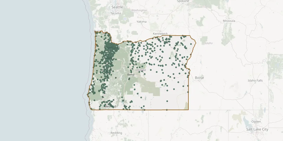 © OpenStreetMap
- Buck Hollow CemeteryGPS coordinates: 45.14314° N, 123.49008° W
- Buena Vista CemeteryGPS coordinates: 44.77579° N, 123.14979° W
- Bullards CemeteryGPS coordinates: 43.15475° N, 124.39692° W
- Bunker Hill CemeteryGPS coordinates: 44.45913° N, 123.06939° W
- Burns CemeteryGPS coordinates: 43.58379° N, 119.06679° W
- Burns Piute CemeteryGPS coordinates: 43.57908° N, 119.09595° W
- Burt CemeteryGPS coordinates: 43.21898° N, 123.26876° W
- Butte Falls CemeteryGPS coordinates: 42.55112° N, 122.60463° W
- Butteville CemeteryGPS coordinates: 45.26663° N, 122.83298° W
- Buxton Community CemeteryGPS coordinates: 45.67974° N, 123.19704° W
- Buzan CemeteryGPS coordinates: 45.17750° N, 120.94000° W
- Caleb CemeteryGPS coordinates: 44.52310° N, 119.93830° W
- Calvary CemeteryGPS coordinates: 45.07535° N, 122.79432° W
- Calvary CemeteryGPS coordinates: 45.31630° N, 118.08432° W
- Campbell-Grier CemeteryGPS coordinates: 44.81407° N, 122.77356° W
- Camp Creek CemeteryGPS coordinates: 44.07911° N, 122.86481° W
- Camp Polk CemeteryGPS coordinates: 44.32300° N, 121.51566° W
- Camp Watson CemeteryGPS coordinates: 44.48444° N, 119.89947° W
- Canemah Pioneer CemeteryGPS coordinates: 45.34177° N, 122.63227° W
- Canyon City CemeteryGPS coordinates: 44.39249° N, 118.93962° W
- Canyonville CemeteryGPS coordinates: 42.93668° N, 123.28171° W
- Cape Blanco Pioneer CemeteryGPS coordinates: 42.84159° N, 124.54266° W
- Carus CemeteryGPS coordinates: 45.27641° N, 122.54977° W
- Cascade Locks CemeteryGPS coordinates: 45.67167° N, 121.88810° W
- Catching Creek CemeteryGPS coordinates: 43.00777° N, 124.21441° W
- Cedar Hill CemeteryGPS coordinates: 43.42392° N, 123.30984° W
- Celilo Indian CemeteryGPS coordinates: 45.65030° N, 120.94560° W
- Cemetery Hill CemeteryGPS coordinates: 44.80539° N, 123.18731° W
- Central Point CemeteryGPS coordinates: 42.38644° N, 122.89180° W
- Central Point IOOF CemeteryGPS coordinates: 42.38651° N, 122.89143° W