
South Dakota
1,217 known cemeteries in South Dakota, United States.
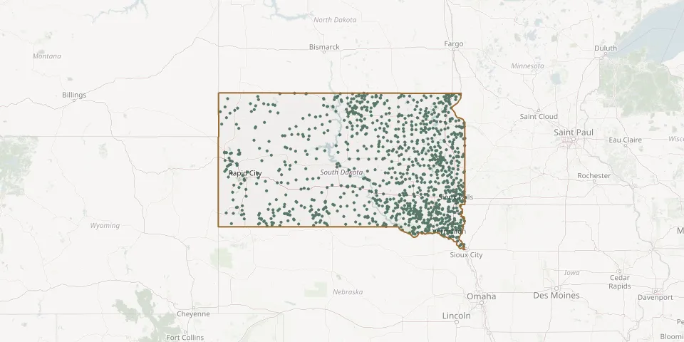 © OpenStreetMap
- Postahl Lutheran CemeteryGPS coordinates: 43.18347° N, 97.88807° W
- Advent CemeteryGPS coordinates: 43.45703° N, 100.28200° W
- Agar CemeteryGPS coordinates: 44.83792° N, 100.06172° W
- Alban Evangelical CemeteryGPS coordinates: 45.19379° N, 96.55850° W
- Albee CemeteryGPS coordinates: 45.05780° N, 96.55720° W
- Alden CemeteryGPS coordinates: 44.67750° N, 99.12030° W
- Allen Community CemeteryGPS coordinates: 43.28358° N, 101.92431° W
- All Saints Catholic CemeteryGPS coordinates: 45.40992° N, 97.91380° W
- All Saints CemeteryGPS coordinates: 44.09737° N, 99.53194° W
- Alma CemeteryGPS coordinates: 45.64690° N, 103.84810° W
- Altoona CemeteryGPS coordinates: 44.61057° N, 98.41166° W
- Aman CemeteryGPS coordinates: 45.80706° N, 99.55418° W
- American Legion CemeteryGPS coordinates: 43.73163° N, 98.03369° W
- Amherst CemeteryGPS coordinates: 45.74732° N, 97.91798° W
- Amunid Emmanual Lutheran CemeteryGPS coordinates: 43.61631° N, 99.23176° W
- Anderson CemeteryGPS coordinates: 44.47470° N, 103.68970° W
- Andover CemeteryGPS coordinates: 45.41640° N, 97.91810° W
- Antelope Valley CemeteryGPS coordinates: 45.19360° N, 96.97420° W
- Antelope Valley CemeteryGPS coordinates: 44.95560° N, 96.49580° W
- Apostolic CemeteryGPS coordinates: 44.56560° N, 97.22830° W
- Aquilla CemeteryGPS coordinates: 44.19640° N, 98.23140° W
- Arena Valley CemeteryGPS coordinates: 45.75164° N, 99.14916° W
- Arlington CemeteryGPS coordinates: 44.35174° N, 97.12755° W
- Artas CemeteryGPS coordinates: 45.87720° N, 99.80110° W
- Ascension Presbyterian CemeteryGPS coordinates: 45.46224° N, 97.05287° W
- Ash Grove CemeteryGPS coordinates: 44.16731° N, 97.11408° W
- Ashton CemeteryGPS coordinates: 44.99126° N, 98.52265° W
- Atfield CemeteryGPS coordinates: 44.50783° N, 98.17452° W
- Athol CemeteryGPS coordinates: 45.01408° N, 98.59485° W
- Augustana CemeteryGPS coordinates: 45.58810° N, 97.99030° W