
Sucre
42 known cemeteries in Sucre, Venezuela.
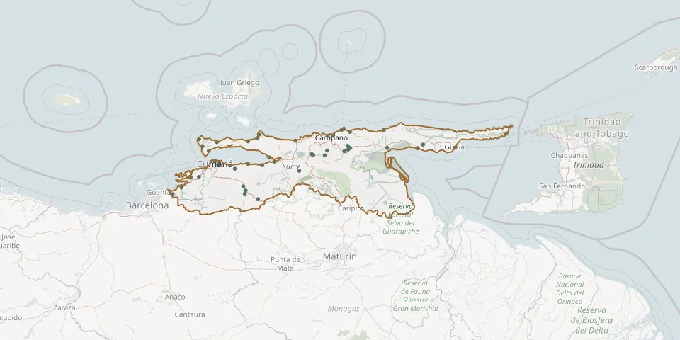 © OpenStreetMap
- Araya CemeteryGPS coordinates: 10.58502° N, 64.25625° W
- Arenas CemeteryGPS coordinates: 10.27774° N, 63.93853° W
- Barbacoa CemeteryGPS coordinates: 10.34917° N, 64.28207° W
- Caiguire CemeteryGPS coordinates: 10.46944° N, 64.15688° W
- Caimancito CemeteryGPS coordinates: 10.62189° N, 63.90212° W
- Campo Claro CemeteryGPS coordinates: 10.59546° N, 62.54430° W
- Carúpano Municipal CemeteryGPS coordinates: 10.66523° N, 63.24329° W
- Catuaro CemeteryGPS coordinates: 10.39575° N, 63.50431° W
- Chacopata CemeteryGPS coordinates: 10.67347° N, 63.81760° W
- Cocollar CemeteryGPS coordinates: 10.17965° N, 63.82423° W
- Cumanacoa CemeteryGPS coordinates: 10.24685° N, 63.92108° W
- Cumaná Park CemeteryGPS coordinates: 10.44445° N, 64.13283° W
- El Guamache CemeteryGPS coordinates: 10.61534° N, 64.14350° W
- El Jobal Park CemeteryGPS coordinates: 10.52292° N, 63.40842° W
- El Morro Main CemeteryGPS coordinates: 10.71596° N, 63.15774° W
- El Pilar Municipal CemeteryGPS coordinates: 10.54532° N, 63.15553° W
- Guacarapo CemeteryGPS coordinates: 10.49839° N, 63.73781° W
- Guarapiche CemeteryGPS coordinates: 10.51585° N, 63.39624° W
- Guaraúnos Local CemeteryGPS coordinates: 10.55877° N, 63.12537° W
- Guayacán CemeteryGPS coordinates: 10.64478° N, 63.82974° W
- Güiria CemeteryGPS coordinates: 10.57017° N, 62.29997° W
- Irapa Municipal CemeteryGPS coordinates: 10.56936° N, 62.58468° W
- La Peña CemeteryGPS coordinates: 10.46569° N, 63.69603° W
- Lechozal CemeteryGPS coordinates: 10.55153° N, 63.28844° W
- Los Altos de Sucre CemeteryGPS coordinates: 10.21751° N, 64.48796° W
- Manicuare CemeteryGPS coordinates: 10.54839° N, 64.20665° W
- Marigüitar CemeteryGPS coordinates: 10.44742° N, 63.89983° W
- Mochima CemeteryGPS coordinates: 10.34505° N, 64.34607° W
- Nueva Colombia CemeteryGPS coordinates: 10.51512° N, 63.30757° W
- Playa Grande CemeteryGPS coordinates: 10.66284° N, 63.28553° W