
Táchira
25 known cemeteries in Táchira, Venezuela.
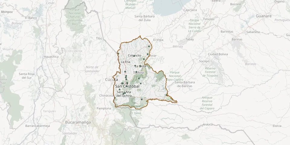 © OpenStreetMap
- Abejales CemeteryGPS coordinates: 7.61721° N, 71.51219° W
- Alto Viento CemeteryGPS coordinates: 7.63908° N, 72.29374° W
- Boca del Grita CemeteryGPS coordinates: 8.36165° N, 72.38537° W
- Borotá CemeteryGPS coordinates: 7.90029° N, 72.24046° W
- Cania Municipal CemeteryGPS coordinates: 7.71661° N, 72.36300° W
- Capacho Nuevo Municipal CemeteryGPS coordinates: 7.82735° N, 72.30540° W
- Capacho Viejo Municipal CemeteryGPS coordinates: 7.82807° N, 72.32011° W
- Coloncito CemeteryGPS coordinates: 8.31793° N, 72.09802° W
- Delicias CemeteryGPS coordinates: 7.56409° N, 72.44988° W
- El Cobre Municipal CemeteryGPS coordinates: 8.03202° N, 72.05789° W
- El Piñal Main CemeteryGPS coordinates: 7.53706° N, 71.95955° W
- La Ermita Municipal CemeteryGPS coordinates: 7.77659° N, 72.23677° W
- La Grita Municipal CemeteryGPS coordinates: 8.13834° N, 71.98454° W
- La Tendida Municipal CemeteryGPS coordinates: 8.49089° N, 71.82889° W
- Lobatera Municipal CemeteryGPS coordinates: 7.93157° N, 72.24984° W
- Michelena Municipal CemeteryGPS coordinates: 7.96215° N, 72.24334° W
- Palmira Municipal CemeteryGPS coordinates: 7.83885° N, 72.22535° W
- Presbítero José Gregario Zambrano Municipal Cemetery, SeborucoGPS coordinates: 8.14429° N, 72.07939° W
- Pueblo Hondo CemeteryGPS coordinates: 8.26254° N, 71.92031° W
- Queniquea Municipal CemeteryGPS coordinates: 7.91565° N, 72.01143° W
- San Juan de Colón Municipal CemeteryGPS coordinates: 8.03661° N, 72.26171° W
- San Pablo CemeteryGPS coordinates: 7.82267° N, 71.97915° W
- San Simón CemeteryGPS coordinates: 8.35165° N, 71.85199° W
- Santa Ana Municipal CemeteryGPS coordinates: 7.65031° N, 72.26510° W
- Táriba CemeteryGPS coordinates: 7.82188° N, 72.22181° W