
Cemetery #171658
Harmannschlag Parish Cemetery
Local name: Pfarrfriedhof Harmannschlag
Also known as Pfarrkirche Harmanschlag
66
documented records
≈ 66–99
approx. capacity (graves)
1,560 m²
cemetery area
Nov 5, 2026
last modified
About this cemetery
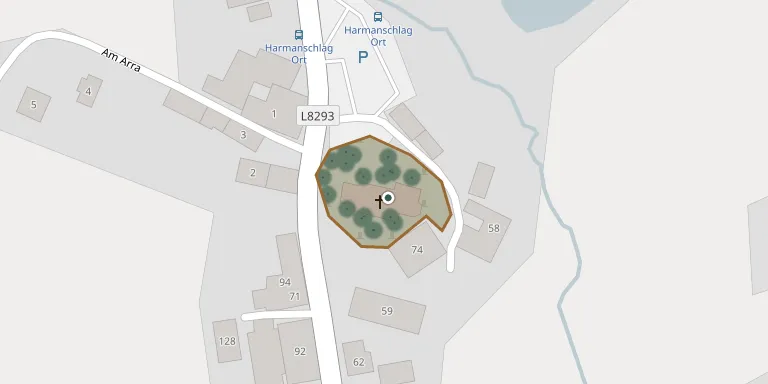
The cemetery surrounds the raised parish church of Harmanschlag, dedicated to St. Wenceslas, in the municipality of St. Martin in Lower Austria. The church has a massive Romanesque west tower. Since 1972 the parish has again been served from Sankt Martin, as it was before 1784.
Cemetery location
GPS coordinates: 48.652298° N, 14.787796° E Directions in Google Maps (opens in a new tab)
Memorials
Showing the first 50 of 66, A–Z by surname. Search all records
 Claudia Altmann 1972 – 2012
 Ignaz Anderl 1886 – 1955
- Josefa Anderl 1897 – 1980
- Otto Anderl 1936 – 2023
 Agnes Bartl 1881 – 1969
- Anna Bartl 1902 – 1992
- Anna Bartl 1942 – 2017
- Franz Bartl 1874 – 1954
- Josef Bartl 1909 – 1988
- Walter Bartl 1934 – 2020
- Walter Bartl 1966 – 1973
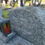 Ignaz Fesl 1898 – 1953
- Theresia Fesl 1900 – 1983
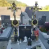 Adelheid Glaser 1911 – 1973
- Josef Glaser 1942 – 2019
- Josef Glaser ? – 1955
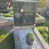 Franz Göll 1885 – 1952
- Rosina Göll 1888 – 1960
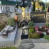 Anna Hangleitner 1924 – 1999
- Franziska Hangleitner 1890 – 1972
- Johann Hangleitner 1890 – 1969
- Alois Höher 1895 – 1974
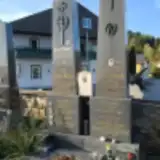 Alois Höher 1882 – 1948
- Anton Höher ? – 1915
- Gerhild Höher 1928 – 2002
- Leo Höher 1899 – 1985
- Leopoldine Höher ? – 1948
- Otto Höher 1932 – 1950
- Andreas Höher-Haidvogl 1893 – 1983
- Leo Höher-Haidvogl 1914 – 2002
- Theresia Höher-Haidvogl 1922 – 2002
 Eleonore Holzmüller 1935 – 1994
- Franz Holzmüller 1926 – 2023
- Angela Holzweber 1929 – 2015
- Josef Holzweber 1912 – 1982
 Manfred Howegger 1963 – 1965
 Amalia Kolbe 1900 – 1958
- Rudolf Kolbe 1888 – 1964
- Leopoldine Krapf 1896 – 1982
- Luise Krapf ? – 1918
- Rudolf Krapf 1882 – 1966
- Wilhelm Krapf 1950 – 2012
 Christine Mosmüller 1898 – 1977
- Johann Mosmüller 1891 – 1974
 Johann Pfeifer 1938 – 2017
 Sophie Poiss 1902 – 1987
- Karoline Pollak 1909 – 2003
- Alois Puchner 1922 – 2003
- Gertrud Puchner 1924 – 2021
- Barbara Schuster 1869 – 1904
Looking for someone who isn't listed? Request a photo.
Nearby cemeteries
The closest other burial grounds listed on EveryStone.
- St. Martin Im Walde Cemetery 4.0 km away · St. Martin · 28 records
- Bad Großpeterholz Cemetery 4.2 km away · Bad Großpertholz · 36 records
- Moorbad Harbach Cemetery 6.0 km away · Harbach · 84 records
- Sankt Wolfgang Cemetery 7.2 km away · Sankt Wolfgang
- Karlstift Cemetery 7.4 km away · Karlstift
- Pohoří na Šumavě Cemetery 8.7 km away · Pohorská Ves
- Hojná Voda Cemetery 9.7 km away · Hojná Voda
- Pfarrkirche Spital bei Weitra 9.8 km away · Spital
- Weitra Cemetery 9.8 km away · Weitra · 317 records
- Pohorská Ves Cemetery 10 km away · Pohorská Ves
Contribute with the app
Our website works smoothly on both desktop and mobile devices. Prefer a native app? Check it out below.
- Capture clear headstone photos
- Save GPS grave locations automatically
- Transcribe inscriptions with our AI
- Suggest corrections to existing records
Common questions
How big is Harmannschlag Parish Cemetery?
Harmannschlag Parish Cemetery covers about 1,560 m² (0.4 acres), about the size of 6 tennis courts. It is the 296th smallest of the 1,114 cemeteries we list in Lower Austria.
What is the oldest grave in this cemetery?
The oldest grave among the records we hold for Harmannschlag Parish Cemetery is that of Elisabeth Stölzle, who died on November 9, 1849 at the age of 36.