
Cemetery #204430
Sapcote Cemetery
1
documented record
≈ 110–220
approx. capacity (graves)
5,430 m²
cemetery area
Oct 18, 2026
last modified
About this cemetery
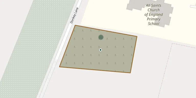
Sapcote Cemetery is on Donkey Lane and is run by Sapcote Parish Council. It is separate from the churchyard of All Saints, though close to it. The cemetery has 626 plots in six areas, including burial sections and cremated remains sections, and an extension was under construction in 2024. Visitors can read more on sapcoteparishcouncil.gov.uk.
Cemetery location
GPS coordinates: 52.533495° N, 1.283611° W Directions in Google Maps (opens in a new tab)
Memorials
1 memorial, A–Z by surname.
Looking for someone who isn't listed? Request a photo.
Nearby cemeteries
The closest other burial grounds listed on EveryStone.
- All Saints Churchyard, Sapcote 200 m away · Sapcote
- St. Helen's Churchyard, Sharnford 1.2 km away · Sharnford
- St Michael's Churchyard 1.7 km away · Stoney Stanton
- Aston Flamville (Saint Peter) Churchyard 2.4 km away · Aston Flamville · 3 records
- Saint Nicholas Churchyard 2.9 km away · Frolesworth
- St Mary Church, Potters Marston 3.4 km away · Potters Marston
- Burbage Cemetery 3.5 km away · Burbage · 20 records
- Broughton Astley Cemetery 3.6 km away · Broughton Astley
- St Michael & All Angels Church, Croft 3.7 km away · Croft
- St Marys Parish Churchyard 4.0 km away · Broughton Astley
Contribute with the app
Our website works smoothly on both desktop and mobile devices. Prefer a native app? Check it out below.
- Capture clear headstone photos
- Save GPS grave locations automatically
- Transcribe inscriptions with our AI
- Suggest corrections to existing records
Common questions
How big is Sapcote Cemetery?
Sapcote Cemetery covers about 5,430 m² (1.3 acres), about the size of a soccer field. It is the 93rd largest of the 305 cemeteries we list in Leicestershire.
What is the oldest grave in this cemetery?
The oldest grave among the records we hold for Sapcote Cemetery is that of Margaret Sarah Slatcher, who died in 1996 at the age of 87.