
Cemetery #206169
Lexington Cemetery
Also known as The Lexington Cemetery
0
documented records
≈ 13k–27k
approx. capacity (graves)
0.670 km²
cemetery area · 165.6 acres
Oct 18, 2026
last modified
About this cemetery
Lexington Cemetery in Lexington, Kentucky, was established in 1848 and incorporated in 1849, laid out as a natural landscape park. It was founded after two cholera epidemics and two decades of rapid population growth. Both Confederate and Union soldiers are buried there.
Cemetery location
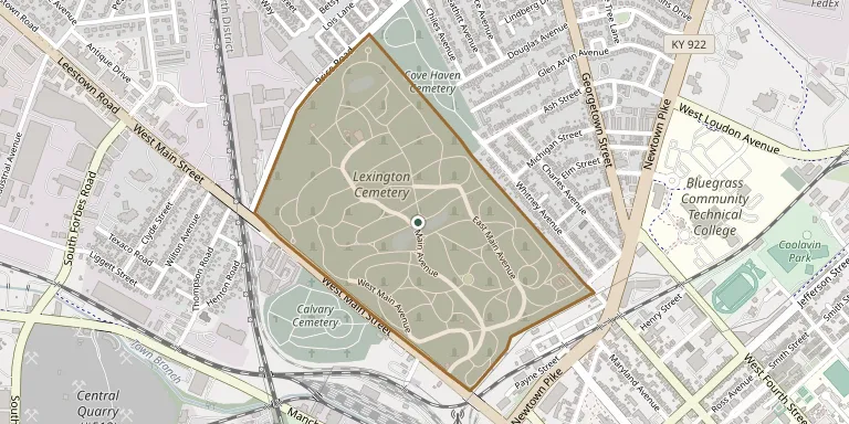
GPS coordinates: 38.060487° N, 84.509275° W Directions in Google Maps (opens in a new tab)
Memorials
No records yet
Photograph a headstone and add it to the archive.
Looking for someone who isn't listed? Request a photo.
Nearby cemeteries
The closest other burial grounds listed on EveryStone.
- Forest Hill Cemetery 330 m away · Lexington
- Lexington National Cemetery 330 m away · Lexington
- Calvary Cemetery 490 m away · Lexington
- Cove Haven Cemetery 520 m away · Lexington
- Eastern State Hospital Cemetery 1.3 km away · Lexington
- Highland Cemetery 1.6 km away · Lexington
- Fayette County Infirmary Cemetery 2.2 km away · Lexington-Fayette
- African Cemetery No. 2, Lexington-Fayette 3.0 km away · Lexington-Fayette
- Hillcrest Memorial Park 3.5 km away · Lexington
- Beatty Family Cemetery 6.3 km away · Lexington
Contribute with the app
Our website works smoothly on both desktop and mobile devices. Prefer a native app? Check it out below.
- Capture clear headstone photos
- Save GPS grave locations automatically
- Transcribe inscriptions with our AI
- Suggest corrections to existing records
Common questions
How big is Lexington Cemetery?
Lexington Cemetery covers about 67 hectares (166 acres), about the same size as Mount Auburn Cemetery in Cambridge, Massachusetts. It is the 4th largest of the 5,785 cemeteries we list in Kentucky.