
Cemetery #206536
Machpelah Cemetery
0
documented records
≈ 1,900–3,800
approx. capacity (graves)
0.095 km²
cemetery area · 23.4 acres
Oct 18, 2026
last modified
About this cemetery
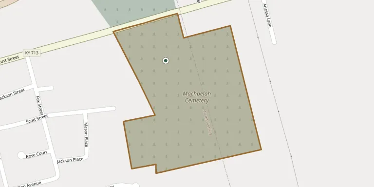
Machpelah Cemetery is a historic burial ground on a steep hill near the eastern city limits of Mount Sterling, Montgomery County, Kentucky. It was formerly called Mount Sterling City Cemetery. The cemetery has been listed on the National Register of Historic Places since April 23, 1991.
Cemetery location
GPS: GPS coordinates: 38.056642° N, 83.931028° W Directions in Google Maps (opens in a new tab)
Memorials
No records yet
Photograph a headstone and add it to the archive.
Looking for someone who isn't listed? Request a photo.
Nearby cemeteries
The closest other burial grounds listed on EveryStone.
- Fairview Cemetery 430 m away · Mount Sterling
- Olive Hill Cemetery 530 m away · Mt Sterling
- Magowan Cemetery 1.5 km away · Mt Sterling
- Enoch Smith Cemetery 2.1 km away · Mount Sterling
- Saint Thomas Cemetery 2.2 km away · Mt Sterling
- Ferguson Cemetery 4.1 km away · Mount Sterling
- Jones Cemetery 5.6 km away · Ewington
- Cravens Cemetery 5.9 km away · Mt Sterling
- Prewitt Cemetery 7.0 km away · Klondike
- French Cemetery, Klondike 7.5 km away · Klondike
Contribute with the app
Our website works smoothly on both desktop and mobile devices. Prefer a native app? Check it out below.
- Capture clear headstone photos
- Save GPS grave locations automatically
- Transcribe inscriptions with our AI
- Suggest corrections to existing records
Common questions
How big is Machpelah Cemetery?
Machpelah Cemetery covers about 95,000 m² (23 acres), about the size of 18 American football fields. It is the 85th largest of the 5,785 cemeteries we list in Kentucky.