
Cemetery #209521
Linden Grove Cemetery
Also known as Historic Linden Grove Cemetery & Arboretum
0
documented records
≈ 1,800–3,600
approx. capacity (graves)
0.090 km²
cemetery area · 22.3 acres
Oct 18, 2026
last modified
About this cemetery
Linden Grove Cemetery in Covington, Kentucky, was founded in 1843 on land owned by the Western Baptist Theological Institute and covers about 22 acres. It was the city's second public cemetery, after Craig Street Cemetery, which closed in 1872 with most of its burials moved to Linden Grove. Burials include Covington's original land owner Thomas Kennedy, and the grounds are now an arboretum.
Cemetery location
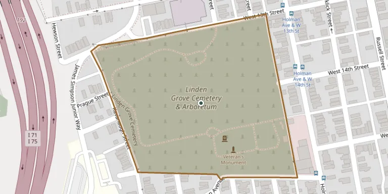
GPS coordinates: 39.074099° N, 84.515236° W Directions in Google Maps (opens in a new tab)
Memorials
No records yet
Photograph a headstone and add it to the archive.
Looking for someone who isn't listed? Request a photo.
Nearby cemeteries
The closest other burial grounds listed on EveryStone.
- Mother of God Cemetery 2.9 km away · Kenton Vale
- Saint John Cemetery 3.6 km away · Fort Mitchell
- Chestnut Street Cemetery 3.7 km away · Cincinnati
- Evergreen Cemetery 3.8 km away · Southgate
- Saint Joseph Cemetery 4.0 km away · Wilder
- Highland Cemetery 4.0 km away · Fort Mitchell
- Saint Mary Cemetery 4.5 km away · Fort Mitchell
- Holy Guardian Angels Cemetery 5.5 km away · Edgewood
- Saint Stephen Cemetery 6.0 km away · Fort Thomas
- Johns Hill Cemetery 6.1 km away · Wilder
Contribute with the app
Our website works smoothly on both desktop and mobile devices. Prefer a native app? Check it out below.
- Capture clear headstone photos
- Save GPS grave locations automatically
- Transcribe inscriptions with our AI
- Suggest corrections to existing records
Common questions
How big is Linden Grove Cemetery?
Linden Grove Cemetery covers about 90,000 m² (22 acres), about the size of 17 American football fields. It is the 87th largest of the 5,785 cemeteries we list in Kentucky.