
Cemetery #25453
Molde Upper Cemetery
Local name: Molde øvre kirkegård
Also known as Molde kirkegård
0
documented records
≈ 100–210
approx. capacity (graves)
5,200 m²
cemetery area
Oct 18, 2026
last modified
About this cemetery
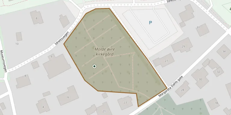
Molde Upper Cemetery is the upper half of Molde Cemetery, the oldest in the town, which is divided into upper and lower parts by Margareta Dahls gate. It is used for burials of coffins and urns in plots already allocated. Two Soviet war dead are buried in a shared grave here, and the Nettgrav database lists 1,352 graves.
Cemetery location
GPS coordinates: 62.739208° N, 7.153350° E Directions in Google Maps (opens in a new tab)
Memorials
No records yet
Photograph a headstone and add it to the archive.
Looking for someone who isn't listed? Request a photo.
Nearby cemeteries
The closest other burial grounds listed on EveryStone.
- Molde Lower Churchyard 120 m away · Molde
- Tøndergaard Cemetery 2.9 km away · Molde
- Hestadholen Cemetery 6.8 km away · Åndal
- Røbekk Cemetery 7.3 km away · Molde
- Røbekk Cemetery 7.4 km away · Røbekk
- Vågøy Churchyard 11 km away · Vågøya
- Vestnes Church Cemetery 13 km away · Vestnes
- Myrbostad Churchyard 13 km away · Moen
- Aukra Churchyard 13 km away · Aukra
- Røvika Cemetery 14 km away · Skåla
Contribute with the app
Our website works smoothly on both desktop and mobile devices. Prefer a native app? Check it out below.
- Capture clear headstone photos
- Save GPS grave locations automatically
- Transcribe inscriptions with our AI
- Suggest corrections to existing records
Common questions
How big is Molde Upper Cemetery?
Molde Upper Cemetery covers about 5,200 m² (1.3 acres), about half the size of a soccer field. It is the 76th smallest of the 156 cemeteries we list in Møre og Romsdal.