
Møre og Romsdal
156 known cemeteries in Møre og Romsdal, Norway.
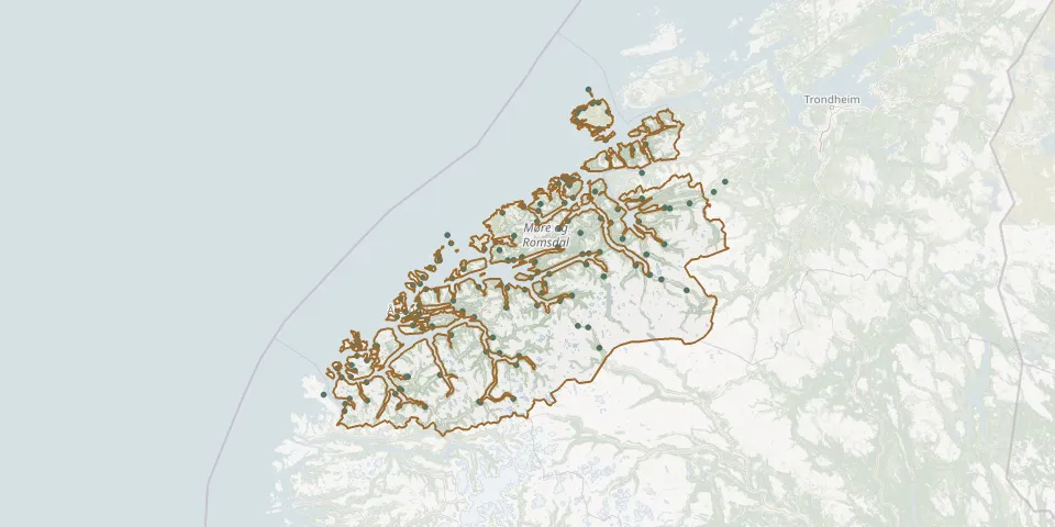 © OpenStreetMap
- Gomalandet gravstedGPS coordinates: 63.11866° N, 7.74228° E
- Frei ChurchyardGPS coordinates: 63.02458° N, 7.80286° E
- Kvernes gravstedGPS coordinates: 63.00180° N, 7.71889° E
- Kirkelandet gravstedGPS coordinates: 63.11682° N, 7.70575° E
- Bolgen gravstedGPS coordinates: 63.08213° N, 7.76757° E
- Folland gravstedGPS coordinates: 62.99653° N, 7.47642° E
- Innlandet gravstedGPS coordinates: 63.10494° N, 7.73794° E
- Nordlandet gravstedGPS coordinates: 63.11142° N, 7.76872° E
- Bremsnes ChurchyardGPS coordinates: 63.08808° N, 7.65884° E
- Borgund Cemetery NorwayGPS coordinates: 62.46649° N, 6.23407° E
- Geiranger Church CemeteryGPS coordinates: 62.09885° N, 7.20719° E
- Ranes Church CemeteryGPS coordinates: 62.97609° N, 8.77199° E
- Noddal CemeteryGPS coordinates: 62.25593° N, 7.23716° E
- Gravstad på RogneGPS coordinates: 62.66050° N, 6.30090° E
- Kornstad ChurchyardGPS coordinates: 62.96517° N, 7.45678° E
- Aalesund Church Western CemeteryGPS coordinates: 62.47156° N, 6.14599° E
- Alders HvileGPS coordinates: 63.11434° N, 7.72473° E
- Ørsta kyrkje cemeteryGPS coordinates: 62.20030° N, 6.13003° E
- Aalesund Nedre CemeteryGPS coordinates: 62.47410° N, 6.23214° E
- Aalesund Øvre CemeteryGPS coordinates: 62.47590° N, 6.23184° E
- Aandalsnes Church CemeteryGPS coordinates: 62.56494° N, 7.68198° E
- Åheim CemeteryGPS coordinates: 62.04000° N, 5.51843° E
- Akselvoll CemeteryGPS coordinates: 62.69928° N, 6.70805° E
- Ålesund North CemeteryGPS coordinates: 62.47729° N, 6.16641° E
- Ålvundeidet CemeteryGPS coordinates: 62.76567° N, 8.53581° E
- Anes fornøielseGPS coordinates: 63.10822° N, 7.80838° E
- Åram CemeteryGPS coordinates: 62.19828° N, 5.49043° E
- Askjellhaugen CemeteryGPS coordinates: 62.20068° N, 6.15114° E
- Åsskard CemeteryGPS coordinates: 63.02110° N, 8.49281° E
- Åsskard Church CemeteryGPS coordinates: 63.01795° N, 8.49651° E