
0
documented records
≈ 170–330
approx. capacity (graves)
8,350 m²
cemetery area
Oct 18, 2026
last modified
About this cemetery
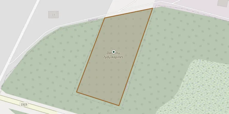
Darbenai Jewish Cemetery is the disused cemetery of the town's Jewish community, a state-protected cultural heritage site of regional importance. It was established in the 19th century and in use until June 1941. Jews are thought to have settled in Darbenai in the mid-18th century. The hilly site is enclosed by a concrete wall and retains gravestones with Hebrew inscriptions. For more information, see esjf-cemeteries.org.
Read more in our story: How to Read a Jewish Gravestone: A Guide to the Matzevah
Cemetery location
GPS coordinates: 56.021431° N, 21.271870° E Directions in Google Maps (opens in a new tab)
Memorials
No records yet
Photograph a headstone and add it to the archive.
Looking for someone who isn't listed? Request a photo.
Nearby cemeteries
The closest other burial grounds listed on EveryStone.
- Darbėnai Town (Baltkalnis) Cemetery 900 m away · Darbėnai
- Darbėnai Town Cemetery 1.5 km away · Darbėnai
- Laukžemė Old Cemetery II 6.2 km away · Laukžemė
- Laukžemė Cemetery 6.5 km away · Laukžemė
- Tūbausiai Village Cemetery 7.3 km away · Tūbausiai
- Mančiai Village Old Cemetery 8.8 km away · Medsėdžiai
- Būtingė Cemetery 9.3 km away · Kalgraužiai
- Senoji Įpiltis Old Cemetery 9.6 km away · Kiaupiškės
- Kalgraužiai Cemetery 9.7 km away · Kalgraužiai
- Voveraičiai Village Old Cemetery I 10 km away · Voveraičiai
Contribute with the app
Our website works smoothly on both desktop and mobile devices. Prefer a native app? Check it out below.
- Capture clear headstone photos
- Save GPS grave locations automatically
- Transcribe inscriptions with our AI
- Suggest corrections to existing records
Common questions
How big is Darbenai Jewish Cemetery?
Darbenai Jewish Cemetery covers about 8,350 m² (2.1 acres), about the size of a soccer field. It is the 52nd largest of the 177 cemeteries we list in Klaipėda County.