
0
documented records
≈ 5.2k–10k
approx. capacity (graves)
0.260 km²
cemetery area
Oct 18, 2026
last modified
About this cemetery
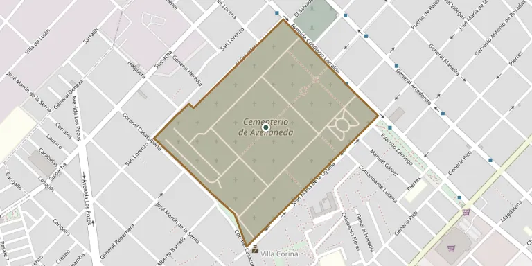
The first public cemetery of Avellaneda was inaugurated in 1865 a few blocks from the town's main square, on the site now occupied by the Fiorito Hospital. The municipal cemetery today stands on Avenida Crisólogo Larralde in Sarandí. Its plan and layout were similar to those of the earlier burial ground on Belgrano Street. Further details are available from mda.gob.ar.
Cemetery location
GPS coordinates: 34.700110° S, 58.347120° W Directions in Google Maps (opens in a new tab)
Memorials
No records yet
Photograph a headstone and add it to the archive.
Looking for someone who isn't listed? Request a photo.
Nearby cemeteries
The closest other burial grounds listed on EveryStone.
- Avellaneda Jewish Cemetery 400 m away · Avellaneda
- Lanus Cemetery 4.7 km away · Remedios de Escalada
- Lomas de Zamora Cemetery 7.4 km away · Lomas de Zamora
- Bene Emeth Sephardic Jewish Cemetery, Lomas de Zamora 7.6 km away · Banfield
- Campo Dorado Private Cemetery 9.6 km away · Barrio Papelero
- Almirante Brown Municipal Cemetery 11 km away · Rafael Calzada
- San José de Flores Cemetery 11 km away · Comuna 7
- Ezpeleta Cemetery 12 km away · Quilmes
- Berazategui Jewish Cemetery 13 km away · Berazategui
- Cottolengo Cemetery 13 km away · San Francisco de Asís
Contribute with the app
Our website works smoothly on both desktop and mobile devices. Prefer a native app? Check it out below.
- Capture clear headstone photos
- Save GPS grave locations automatically
- Transcribe inscriptions with our AI
- Suggest corrections to existing records
Common questions
How big is Avellaneda Cemetery?
Avellaneda Cemetery covers about 26 hectares (260,000 m²), about the same size as Staglieno Cemetery in Genoa. It is the 6th largest of the 264 cemeteries we list in Buenos Aires.