
Cemetery #318081
Mahlsdorf Cemetery
Local name: Friedhof Mahlsdorf
Also known as Evangelischer Friedhof-Mahlsdorf
0
documented records
≈ 580–1,200
approx. capacity (graves)
0.029 km²
cemetery area
Oct 18, 2026
last modified
About this cemetery
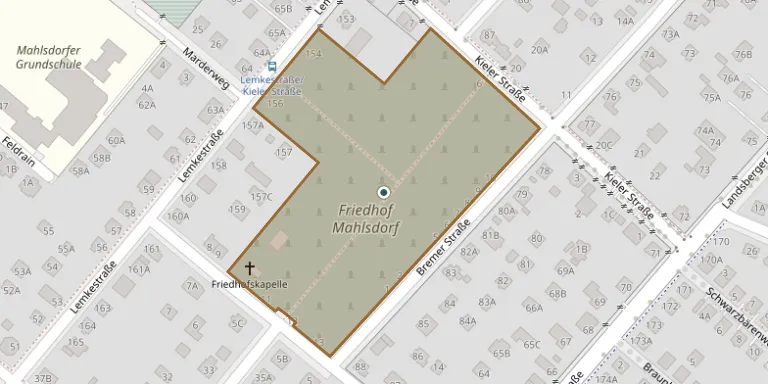
The communal cemetery in Mahlsdorf was opened in 1919 and covers 28,951 square metres. It belongs to the State of Berlin and is administered by the Marzahn-Hellersdorf district office. In 1967 it was extended westward towards Lemkestraße onto the property of the Jewish Guthmann family, who lived there until their deportation in 1943; a memorial plaque for the family has stood at the entrance since 2018.
Cemetery location
GPS coordinates: 52.521319° N, 13.633459° E Directions in Google Maps (opens in a new tab)
Memorials
No records yet
Photograph a headstone and add it to the archive.
Looking for someone who isn't listed? Request a photo.
Nearby cemeteries
The closest other burial grounds listed on EveryStone.
- Hönow Cemetery 1.7 km away · Neuenhagen
- Hoppegarten Cemetery 2.1 km away · Dahlwitz
- Mahlsdorf Old Churchyard 2.2 km away · Marzahn
- Hönow Evangelical Cemetery 2.8 km away · Hönow Dorf
- Mahlsdorf Evangelical Cemetery 3.1 km away · Berlin–Hellersdorf
- Neuenhagen North Cemetery 3.7 km away · Neuenhagen bei Berlin
- Neuenhagen Woodland Cemetery 3.7 km away · Neuenhagen
- Kaulsdorf Cemetery 4.1 km away · Kaulsdorf
- Münchehofe Cemetery 4.2 km away · Münchehofe
- Wuhlgarten Peace Park Cemetery 4.4 km away · Berlin
Contribute with the app
Our website works smoothly on both desktop and mobile devices. Prefer a native app? Check it out below.
- Capture clear headstone photos
- Save GPS grave locations automatically
- Transcribe inscriptions with our AI
- Suggest corrections to existing records
Common questions
How big is Mahlsdorf Cemetery?
Mahlsdorf Cemetery covers about 29,000 m² (7.1 acres), about the size of 4 soccer fields. It is the 108th largest of the 2,113 cemeteries we list in Brandenburg.