
Brandenburg
2,113 known cemeteries in Brandenburg, Germany.
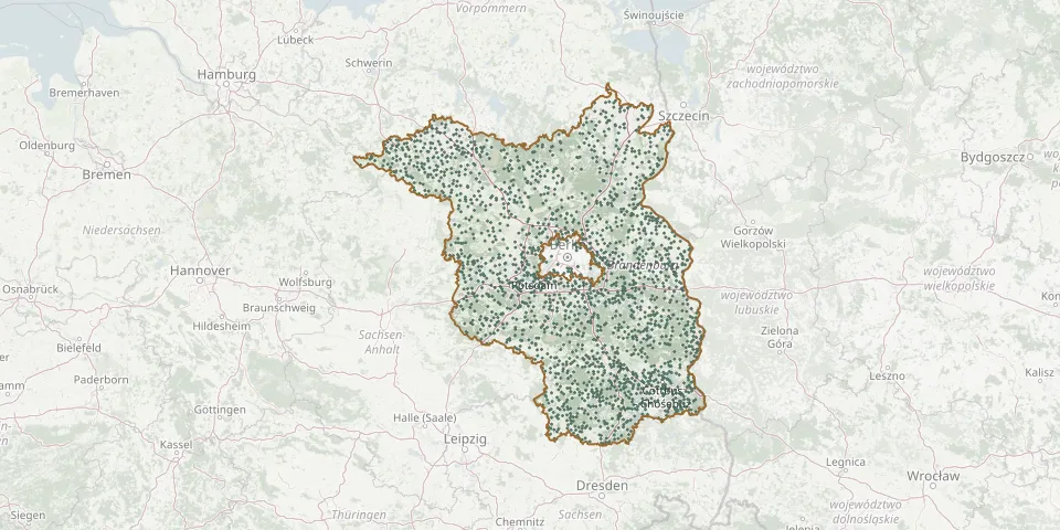 © OpenStreetMap
- Albrechts Teerofen Italian Military War CemeteryGPS coordinates: 52.38301° N, 13.17644° E
- Stahnsdorf South-Western CemeteryGPS coordinates: 52.38333° N, 13.17521° E
- Frankfurt Oder Main CemeteryGPS coordinates: 52.32859° N, 14.53019° E
- Oranienburg Municipal CemeteryGPS coordinates: 52.74741° N, 13.22692° E
- Rathenow Evangelical CemeteryGPS coordinates: 52.60218° N, 12.33160° E
- Plessa CemeteryGPS coordinates: 51.46736° N, 13.61654° E
- Fürstenwalde New CemeteryGPS coordinates: 52.35262° N, 14.04632° E
- Leegebruch CemeteryGPS coordinates: 52.71727° N, 13.20056° E
- Fürstenwalde Woodland CemeteryGPS coordinates: 52.37621° N, 14.04474° E
- Bernau New CemeteryGPS coordinates: 52.68320° N, 13.59490° E
- Wandlitz CemeteryGPS coordinates: 52.74579° N, 13.45418° E
- Bornstedter CemeteryGPS coordinates: 52.40910° N, 13.02790° E
- Kleinmachnow Italian Cemetery of HonourGPS coordinates: 52.42448° N, 13.21331° E
- Velten Old CemeteryGPS coordinates: 52.68827° N, 13.17110° E
- Brandenburg an der Havel Neustadt CemeteryGPS coordinates: 52.40356° N, 12.56570° E
- Sachsenhausen CemeteryGPS coordinates: 52.78277° N, 13.24312° E
- Lehnitz CemeteryGPS coordinates: 52.74787° N, 13.27711° E
- Ruhlsdorf Cemetery, TeltowGPS coordinates: 52.37061° N, 13.25527° E
- Schmachtenhagen CemeteryGPS coordinates: 52.76781° N, 13.32239° E
- Klosterfelde CemeteryGPS coordinates: 52.79143° N, 13.48184° E
- Wulkow War CemeteryGPS coordinates: 52.40248° N, 14.47326° E
- Friedrichsthal CemeteryGPS coordinates: 52.79670° N, 13.28001° E
- Königshorst CemeteryGPS coordinates: 52.70967° N, 12.79473° E
- Bernau Old CemeteryGPS coordinates: 52.68050° N, 13.58500° E
- Schönwalde Evangelical CemeteryGPS coordinates: 52.68085° N, 13.44303° E
- Basdorf CemeteryGPS coordinates: 52.72883° N, 13.44392° E
- Bornim New CemeteryGPS coordinates: 52.42458° N, 12.98580° E
- Teltower-Vorstadt Old CemeteryGPS coordinates: 52.38644° N, 13.07324° E
- Brandenburg Main CemeteryGPS coordinates: 52.43502° N, 12.51537° E
- Bad Freienwalde CemeteryGPS coordinates: 52.77630° N, 14.04543° E