
Brandenburg
2,113 known cemeteries in Brandenburg, Germany.
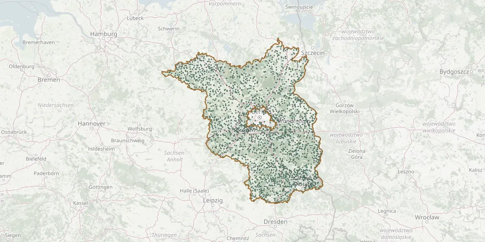 © OpenStreetMap
- Langendamm CemeteryGPS coordinates: 52.33539° N, 13.95130° E
- Nikolai-KirchgemeindeGPS coordinates: 52.14846° N, 14.67028° E
- Rühstädt Evangelical CemeteryGPS coordinates: 52.91887° N, 11.87007° E
- Staffelde CemeteryGPS coordinates: 52.73192° N, 12.99354° E
- Dorfkirche Sonnenberg OberhavelGPS coordinates: 53.01944° N, 13.08954° E
- Fredersdorf South Evangelical Parish CemeteryGPS coordinates: 52.51306° N, 13.74761° E
- Glienicke Woodland CemeteryGPS coordinates: 52.63372° N, 13.33962° E
- Linum CemeteryGPS coordinates: 52.76129° N, 12.87109° E
- Badingen CemeteryGPS coordinates: 52.99510° N, 13.25051° E
- Bernöwe Municipal CemeteryGPS coordinates: 52.81784° N, 13.33360° E
- Falkenhagen CemeteryGPS coordinates: 53.20825° N, 12.19546° E
- Fehrbellin Evangelical CemeteryGPS coordinates: 52.84860° N, 12.86205° E
- Markee CemeteryGPS coordinates: 52.57704° N, 12.87129° E
- Meseberg CemeteryGPS coordinates: 52.97063° N, 13.10052° E
- SenftenhuetteGPS coordinates: 52.93016° N, 13.85472° E
- Vehlefanz CemeteryGPS coordinates: 52.72474° N, 13.09788° E
- Alt Stahnsdorf CemeteryGPS coordinates: 52.28364° N, 13.87805° E
- Dahlhausen CemeteryGPS coordinates: 53.06572° N, 12.32949° E
- Hirschfeld CemeteryGPS coordinates: 51.38786° N, 13.61218° E
- Ketzin CemeteryGPS coordinates: 52.47489° N, 12.84993° E
- Lunow CemeteryGPS coordinates: 52.92885° N, 14.11896° E
- Oranienburg Jewish CemeteryGPS coordinates: 52.75066° N, 13.22810° E
- Pieskow CemeteryGPS coordinates: 52.26712° N, 14.06322° E
- Boernicke CemeteryGPS coordinates: 52.68262° N, 12.94008° E
- Buckow CemeteryGPS coordinates: 52.56716° N, 14.08271° E
- Dorfkirche BörnickeGPS coordinates: 52.66290° N, 13.63698° E
- Guben Woodland CemeteryGPS coordinates: 51.95472° N, 14.67323° E
- Horno CemeteryGPS coordinates: 51.75428° N, 14.62276° E
- Ketschendorfer CemeteryGPS coordinates: 52.33151° N, 14.07000° E
- Kleinmachnow Village ChurchyardGPS coordinates: 52.39490° N, 13.22383° E