
Brandenburg
2,113 known cemeteries in Brandenburg, Germany.
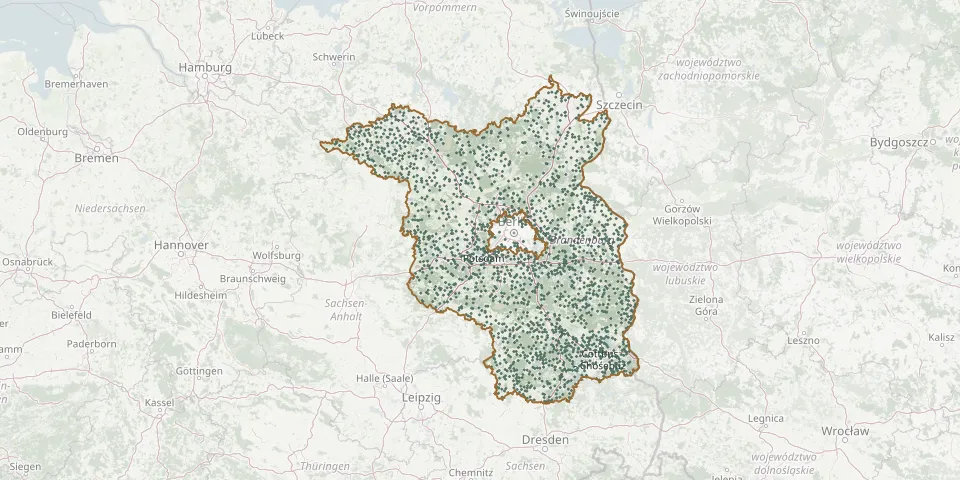 © OpenStreetMap
- Goethestraße CemeteryGPS coordinates: 52.39708° N, 13.10536° E
- Wildberg CemeteryGPS coordinates: 52.87579° N, 12.62599° E
- Oranienburg Catholic CemeteryGPS coordinates: 52.74472° N, 13.24453° E
- Teschendorf CemeteryGPS coordinates: 52.85875° N, 13.17602° E
- Nordgraben Cemetery, BerlinGPS coordinates: 52.59346° N, 13.28996° E
- Guben West CemeteryGPS coordinates: 51.94937° N, 14.69004° E
- Lietzen War CemeteryGPS coordinates: 52.47623° N, 14.35109° E
- Rönnebeck CemeteryGPS coordinates: 53.00393° N, 13.04012° E
- Velten New CemeteryGPS coordinates: 52.68919° N, 13.16915° E
- Wensickendorf CemeteryGPS coordinates: 52.75253° N, 13.37106° E
- Wolfshagen CemeteryGPS coordinates: 53.44158° N, 13.65818° E
- Zehlendorf Cemetery near OranienburgGPS coordinates: 52.77853° N, 13.38443° E
- Baerenklau CemeteryGPS coordinates: 52.71770° N, 13.15031° E
- Gransee CemeteryGPS coordinates: 53.00554° N, 13.16616° E
- Nassenheide CemeteryGPS coordinates: 52.81357° N, 13.21159° E
- Neustadt Dosse Municipal CemeteryGPS coordinates: 52.86500° N, 12.43040° E
- Bredow CemeteryGPS coordinates: 52.59098° N, 12.92607° E
- Rauen CemeteryGPS coordinates: 52.32856° N, 14.03159° E
- Germendorf CemeteryGPS coordinates: 52.74722° N, 13.17187° E
- Gross-ZiethenGPS coordinates: 52.95765° N, 13.89205° E
- Schönfließ CemeteryGPS coordinates: 52.65741° N, 13.33678° E
- Elsterwerda Mountain CemeteryGPS coordinates: 51.46739° N, 13.53384° E
- Erkner CemeteryGPS coordinates: 52.41701° N, 13.76028° E
- Fiedhof DannenwaldeGPS coordinates: 53.02422° N, 12.23868° E
- Hohen Neuendorf CemeteryGPS coordinates: 52.67457° N, 13.27180° E
- Marwitz CemeteryGPS coordinates: 52.67295° N, 13.14575° E
- Island Town Werder Old CemeteryGPS coordinates: 52.37682° N, 12.94417° E
- Köpernitz Woodland CemeteryGPS coordinates: 53.06301° N, 12.94835° E
- Müncheberg Woodland CemeteryGPS coordinates: 52.50435° N, 14.10339° E
- Arensdorf CemeteryGPS coordinates: 52.42969° N, 14.24028° E