
Brandenburg
2,113 known cemeteries in Brandenburg, Germany.
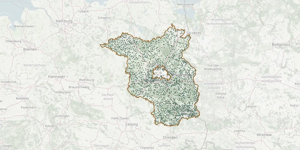 © OpenStreetMap
- Malz CemeteryGPS coordinates: 52.80261° N, 13.29336° E
- OT Rauschendorf CemeteryGPS coordinates: 53.03262° N, 13.11547° E
- Pinnow CemeteryGPS coordinates: 53.05947° N, 14.08458° E
- SchoenermarkGPS coordinates: 53.00661° N, 13.12099° E
- Dorfkirche FretzdorfGPS coordinates: 53.06625° N, 12.54831° E
- Dorfkirche ZehlendorfGPS coordinates: 52.78390° N, 13.38674° E
- Eichstädt CemeteryGPS coordinates: 52.69218° N, 13.11577° E
- Jeserig CemeteryGPS coordinates: 52.41263° N, 12.69357° E
- Potsdam New CemeteryGPS coordinates: 52.38438° N, 13.07122° E
- Stahnsdorf Village ChurchyardGPS coordinates: 52.39199° N, 13.21612° E
- Stolpe CemeteryGPS coordinates: 52.98037° N, 14.11317° E
- Wulkow CemeteryGPS coordinates: 52.40303° N, 14.46857° E
- Arendsee CemeteryGPS coordinates: 53.33102° N, 13.62933° E
- Baumgart CemeteryGPS coordinates: 52.98079° N, 13.07442° E
- Braunsdorf CemeteryGPS coordinates: 52.36245° N, 13.95869° E
- Brunne CemeteryGPS coordinates: 52.77531° N, 12.72887° E
- Glienicke/Nordbahn Evangelical CemeteryGPS coordinates: 52.62993° N, 13.32057° E
- Großkmehlen ChurchyardGPS coordinates: 51.37933° N, 13.72407° E
- Gross Marzehns CemeteryGPS coordinates: 51.99222° N, 12.58552° E
- Guehlen-Glienicke CemeteryGPS coordinates: 53.05092° N, 12.75871° E
- Heiligengrabe CemeteryGPS coordinates: 53.14113° N, 12.35149° E
- Heinersdorf CemeteryGPS coordinates: 52.38751° N, 13.32769° E
- HohenlandinGPS coordinates: 53.08801° N, 14.13080° E
- Petersdorf CemeteryGPS coordinates: 52.31391° N, 14.06531° E
- Sacrow CemeteryGPS coordinates: 52.42810° N, 13.08930° E
- Storkow Municipal CemeteryGPS coordinates: 52.27375° N, 13.99996° E
- Altthymener CemeteryGPS coordinates: 53.23847° N, 13.16341° E
- Dechtow CemeteryGPS coordinates: 52.75707° N, 12.80572° E
- Kolberg CemeteryGPS coordinates: 52.24420° N, 13.80857° E
- Rathenow Soviet Cemetery of HonourGPS coordinates: 52.60208° N, 12.35307° E