
Cemetery #31842
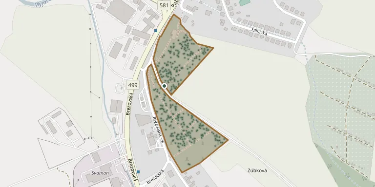
Myjava Lower Cemetery
Local name: Myjava dolný cintorín
Also known as Dolný cintorín, Myjava
942
documented records
≈ 1,200–2,300
approx. capacity (graves)
0.058 km²
cemetery area
Oct 18, 2026
last modified
About this cemetery
The Lower Cemetery (Dolný cintorín) is one of two town cemeteries in Myjava, Slovakia, alongside the Upper Cemetery, and is managed by the company Správa majetku mesta Myjava. Further details are available from cintoriny.sk.
Cemetery location
GPS coordinates: 48.742802° N, 17.561501° E Directions in Google Maps (opens in a new tab)
Memorials
Showing the first 50 of 942, A–Z by surname. Search all records
 Alžbeta Adamcová 1921 – 1992
- Alžbeta Adamcová ? – 1967
 Anna Adamcová 1887 – 1927
 Anna Adamcová 1915 – 2003
- Daniel Adamec ? – 1973
- Ján Adamec 1949 – 2021
- Ján Adamec 1921 – 1984
- Michal Adamec 1917 – 1970
 Emília Adámková 1938 – 1979
 Samuel Adásek 1907 – 1992
- Kristína Adásková 1907 – 1994
 Libor Babiak 1930 – 1981
 Ján Babiar 1929 – 2009
 Michal Babiar 1926 – 2012
- Michal Babiar 1891 – 1980
- Samuel Babiar 1897 – 1991
- Anna Babiarová 1939 – 2022
- Božena Babiarová 1927 – 2013
- Justína Babiarová 1894 – 1979
- Katarína Babiarová 1902 – 1991
 Dušan Bača 1950 – 2019
 Pavel Bachár 1914 – 1999
 Samuel Bachár 1900 – 1939
- Kristína Bachárová 1923 – 1989
 Samuel Bačo 1914 – 1999
- Alžbeta Bačová 1935 – 2020
 Imrich Bagala 1923 – 2016
- Jaroslav Bagala 1952 – 2021
- Pavol Bagala 1960 – 1981
 Samuel Bajcar 1895 – 1931
 Štefan Bajcár 1929 – 2002
- Emília Bajcarová 1938 – 2021
- Zuzana Bajcarová 1892 – 1987
 Pavel Bakoš 1910 – 1993
- Eva Bakošová 1919 – 1991
 Martin Barbierik 1924 – 2000
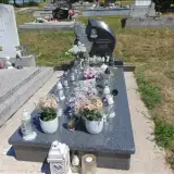 Dominika Barbieriková 2012 – 2016
- Oľga Barbieriková 1927 – 2012
 Ján Bartek 1901 – 1988
- Ján Bartek 1930 – 2023
- Emília Barteková 1935 – 2018
- Zuzana Barteková 1899 – 1982
- Valéria Bašnaáová 1941 – 1989
- Jozef Bašnák 1939 – 2001
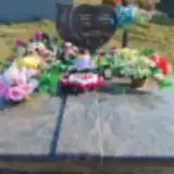 Slavomír Bašnár 1973 – 2022
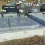 Milan Ján Bednár 1937 – 1938
- Kristína Bednárová 1906 – 1995
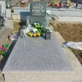 Ján Belenčiak 1915 – 1981
- Anna Belenčiaková 1922 – 2001
 Ján Bernátek 1910 – 1988
Looking for someone who isn't listed? Request a photo.
Nearby cemeteries
The closest other burial grounds listed on EveryStone.
- Myjava Jewish Cemetery 390 m away · Myjava
- Myjava Upper Cemetery 2.3 km away · Myjava · 490 records
- Turá Lúka Cemetery 2.5 km away · Myjava · 215 records
- Brezová pod Bradlom Cemetery 8.1 km away · Brezová pod Bradlom
- Košariská Cemetery 8.6 km away · Košariská · 711 records
- U mosnákov Cemetery, Košariská 9.5 km away · Košariská · 31 records
- Vrbovce Jewish Cemetery 9.8 km away · Vrbovce
- Stará Turá Jewish Cemetery 10 km away · Stará Turá
- Stará Turá Catholic Cemetery 10 km away · Stará Turá
- Podkylava Cemetery 10 km away · Podkylava
Contribute with the app
Our website works smoothly on both desktop and mobile devices. Prefer a native app? Check it out below.
- Capture clear headstone photos
- Save GPS grave locations automatically
- Transcribe inscriptions with our AI
- Suggest corrections to existing records
Common questions
How big is Myjava Lower Cemetery?
Myjava Lower Cemetery covers about 58,000 m² (14 acres), about the size of 8 soccer fields. It is the 6th largest of the 387 cemeteries we list in Region of Trenčín.
What is the oldest grave in this cemetery?
The oldest grave among the records we hold for Myjava Lower Cemetery is that of Emília Lacková, who died on August 10, 1910 at the age of 63.