
Cemetery #32174
Dranouter Churchyard
Local name: Kerkhof Dranouter
Also known as Sint Jan Baptistkerk, Dranouter · Kerkhof van Dranouter · Dranouter Churchyard, Commonwealth Plot
0
documented records
≈ 9–18
approx. capacity (graves)
450 m²
cemetery area
Oct 18, 2026
last modified
About this cemetery
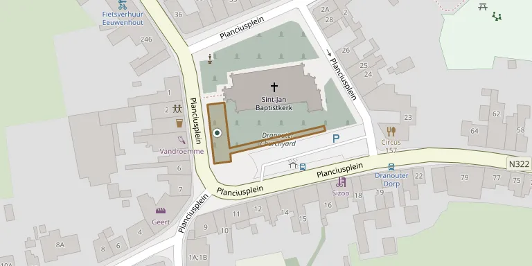
Dranouter churchyard is the municipal cemetery of the village of Dranouter in Heuvelland, lying in the village centre around the church. Several British soldiers of the First World War are buried around the church. The churchyard is 11.5 kilometres south of Ieper town centre. To learn more, visit cwgc.org.
Cemetery location
GPS coordinates: 50.766140° N, 2.783040° E Directions in Google Maps (opens in a new tab)
Memorials
No records yet
Photograph a headstone and add it to the archive.
Looking for someone who isn't listed? Request a photo.
Nearby cemeteries
The closest other burial grounds listed on EveryStone.
- Dranoutre Military Cemetery 210 m away · Ieper
- Locre No. 10 770 m away · Ieper
- Grave of Willie Redmond 1.4 km away · Loker
- Locre Hospice Cemetery 1.4 km away · Ieper
- Loker Churchyard 2.0 km away · Ieper
- Kemmelberg French Ossuary 2.3 km away · Heuvelland
- BE-war Lindenhoek Chalet Military Cemetery 3.1 km away · Heuvelland
- Mont Noir Military Cemetery 3.5 km away · Saint-Jans-Cappel
- Packhorse Farm Shrine Cemetery 3.6 km away · Ieper
- Westhof Farm Cemetery 3.6 km away · Ieper · 2 records
Contribute with the app
Our website works smoothly on both desktop and mobile devices. Prefer a native app? Check it out below.
- Capture clear headstone photos
- Save GPS grave locations automatically
- Transcribe inscriptions with our AI
- Suggest corrections to existing records
Common questions
How big is Dranouter Churchyard?
Dranouter Churchyard covers about 450 m² (0.1 acres), about the size of 2 tennis courts. It is the 42nd smallest of the 503 cemeteries we list in West Flanders.