
0
documented records
≈ 230–460
approx. capacity (graves)
0.011 km²
cemetery area
Oct 18, 2026
last modified
About this cemetery
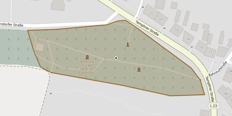
Joachimsthal's Jewish dead were first buried at Oderberg. In 1750 the six Jewish families then living in the town were able to establish their own burial ground, near the municipal cemetery on Zorndorfer Straße. During the GDR period the Christian cemeteries and the Jewish part were administered together. Questions about visits or burials can go to +49 33361 64621; more information is available from amt-joachimsthal.de.
Cemetery location
GPS coordinates: 52.980360° N, 13.743104° E Directions in Google Maps (opens in a new tab)
Memorials
No records yet
Photograph a headstone and add it to the archive.
Looking for someone who isn't listed? Request a photo.
Nearby cemeteries
The closest other burial grounds listed on EveryStone.
- Joachimsthal Cemetery 730 m away · Joachimsthal
- Mellen Cemetery 5.2 km away · Parlow
- Friedrichswalde Cemetery 5.8 km away · Friedrichswalde
- Glambeck Cemetery 7.2 km away · Friedrichswalde
- Altenhof Cemetery 7.5 km away · Schorfheide
- Ringenwalde Cemetery 8.3 km away · Ringenwalde
- Golzow Cemetery 9.1 km away · Golzow
- Senftenhuette 9.3 km away · Chorin · 8 records
- Altkünkendorf Cemetery 9.5 km away · Altkünkendorf
- Poratz Cemetery 9.7 km away · Poratz
Contribute with the app
Our website works smoothly on both desktop and mobile devices. Prefer a native app? Check it out below.
- Capture clear headstone photos
- Save GPS grave locations automatically
- Transcribe inscriptions with our AI
- Suggest corrections to existing records
Common questions
How big is Joachimsthal Jewish Cemetery?
Joachimsthal Jewish Cemetery covers about 11,000 m² (2.8 acres), about the size of 2 soccer fields. It is the 287th largest of the 2,113 cemeteries we list in Brandenburg.