
0
documented records
≈ 82–160
approx. capacity (graves)
4,090 m²
cemetery area
Oct 18, 2026
last modified
About this cemetery
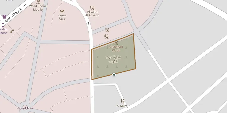
Kut War Cemetery was made by the 6th (Poona) Division between October 1915 and May 1916, during the Siege of Kut. It lies about 160 km south of Baghdad and is the resting place of British and Indian soldiers who died fighting the Ottoman army.
Cemetery location
GPS coordinates: 32.496430° N, 45.828780° E Directions in Google Maps (opens in a new tab)
Memorials
No records yet
Photograph a headstone and add it to the archive.
Looking for someone who isn't listed? Request a photo.
Nearby cemeteries
The closest other burial grounds listed on EveryStone.
- Seyyed Hasan Cemetery 75 km away · Seyyed Hasan
- Maqbarat Maqām Şāḩib az Zamān 84 km away · Al-Salihiyah
- Kavar Cemetery 102 km away · Kavar
- Saleh Abad Cemetery 113 km away · Saleh Abad
- Qabrestān-e Malekshāhī 121 km away · Arkavaz
- Andisheh Quarter Cemetery 137 km away · Dehloran
- Chavar Cemetery 140 km away · Chavar
- Imam Mansur Cemetery 141 km away · Sumayr al Muhammad
- Amara War Cemetery 145 km away · Al ‘Amārah
- Amara (Left Bank) Indian War Cemetery 145 km away · Al ‘Amārah
Contribute with the app
Our website works smoothly on both desktop and mobile devices. Prefer a native app? Check it out below.
- Capture clear headstone photos
- Save GPS grave locations automatically
- Transcribe inscriptions with our AI
- Suggest corrections to existing records
Common questions
How big is Kut War Cemetery?
Kut War Cemetery covers about 4,090 m² (1 acre), about half the size of a soccer field.