
0
documented records
≈ 15–31
approx. capacity (graves)
760 m²
cemetery area
Oct 18, 2026
last modified
About this cemetery
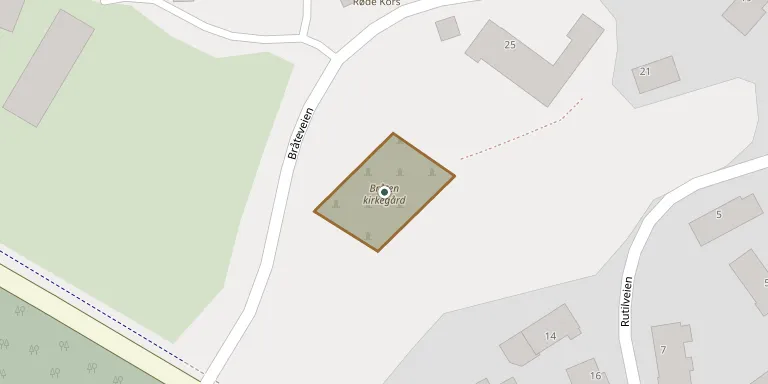
Bråten kirkegård is a burial ground just east of Kalstad in Kragerø, set in a small wood. It served as Kragerø's churchyard from 1846 to 1862, when Kalstad cemetery was taken into use. In 2026 it was reported to still bear damage from the storm Amy, including fallen trees and a broken stairway.
Cemetery location
GPS coordinates: 58.868912° N, 9.396537° E Directions in Google Maps (opens in a new tab)
Memorials
No records yet
Photograph a headstone and add it to the archive.
Looking for someone who isn't listed? Request a photo.
Nearby cemeteries
The closest other burial grounds listed on EveryStone.
- Dahl Churchyard 260 m away · Kragerø
- Kragerø Cemetery 910 m away · Kragerø
- Skaatøy Cemetery 4.7 km away · Skåtøy
- Støle Churchyard 5.4 km away · Støle
- Ospevika Churchyard 7.7 km away · Kragerø · 49 records
- Sannidal Churchyard 8.0 km away · Sannidal
- Nistesvåg Churchyard 14 km away · Hødnebø
- Rørholt gravsted 15 km away · Rørholt
- Kroken Churchyard 17 km away · Fosstveit
- Risor Civil Cemetery 19 km away · Risør
Contribute with the app
Our website works smoothly on both desktop and mobile devices. Prefer a native app? Check it out below.
- Capture clear headstone photos
- Save GPS grave locations automatically
- Transcribe inscriptions with our AI
- Suggest corrections to existing records
Common questions
How big is Bråten Churchyard?
Bråten Churchyard covers about 760 m² (0.2 acres), about the size of 3 tennis courts. It is the 2nd smallest of the 74 cemeteries we list in Telemark.